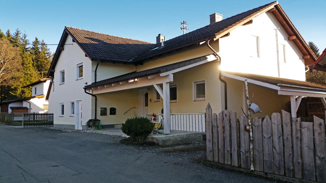
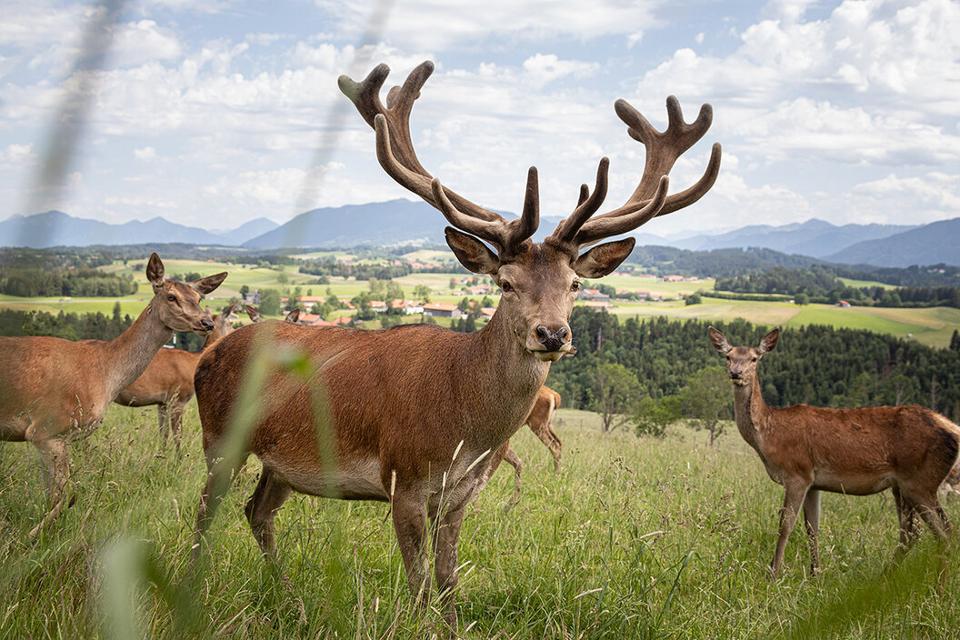
Besonders geeignet für:


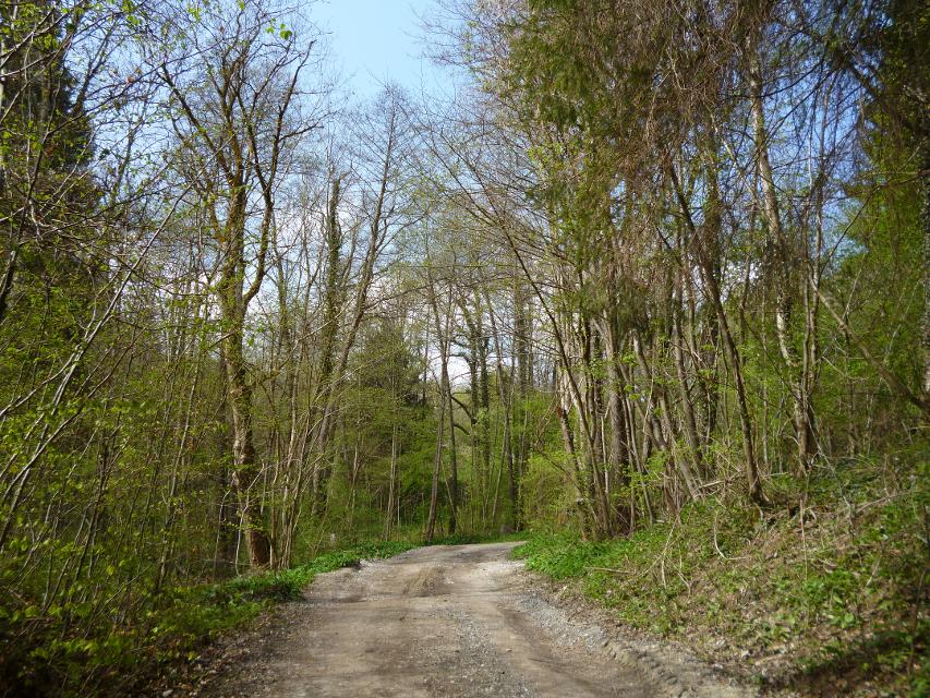


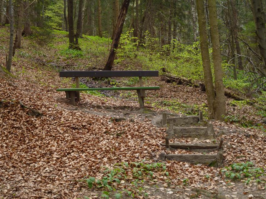
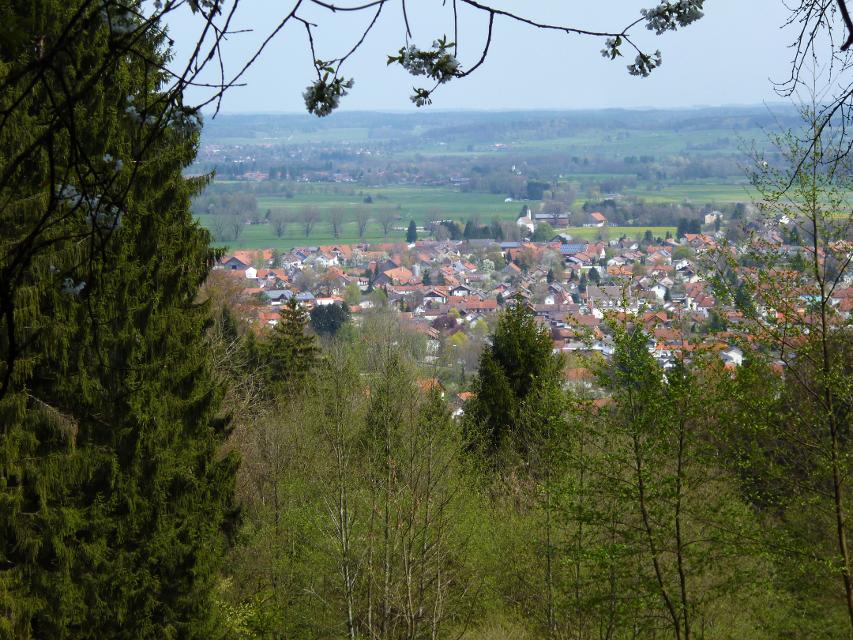
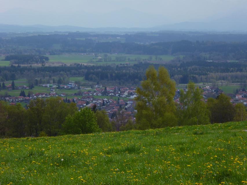
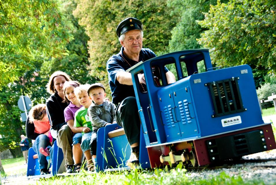
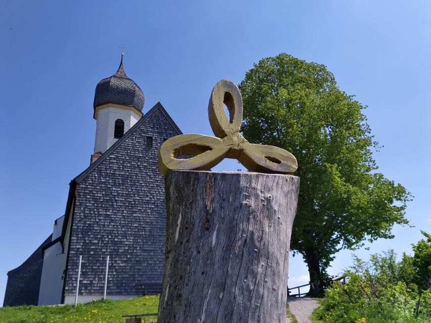
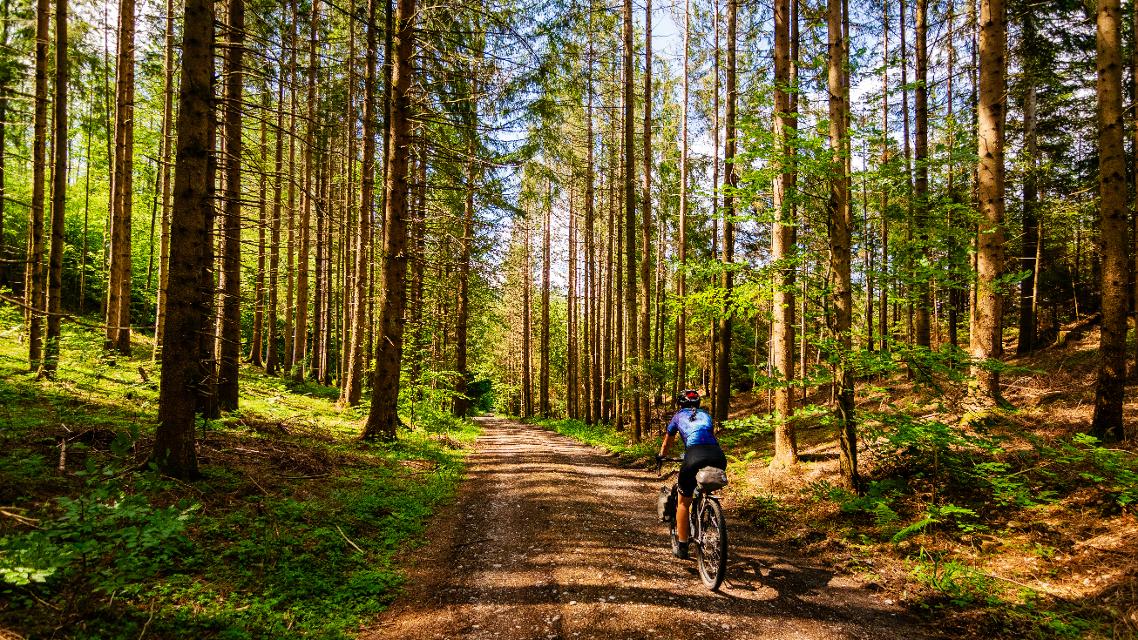
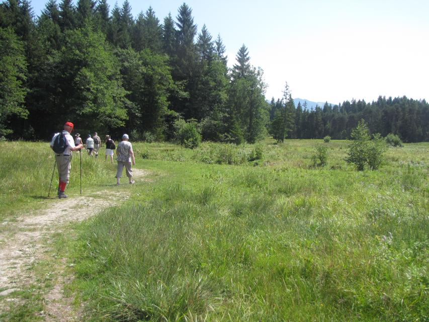
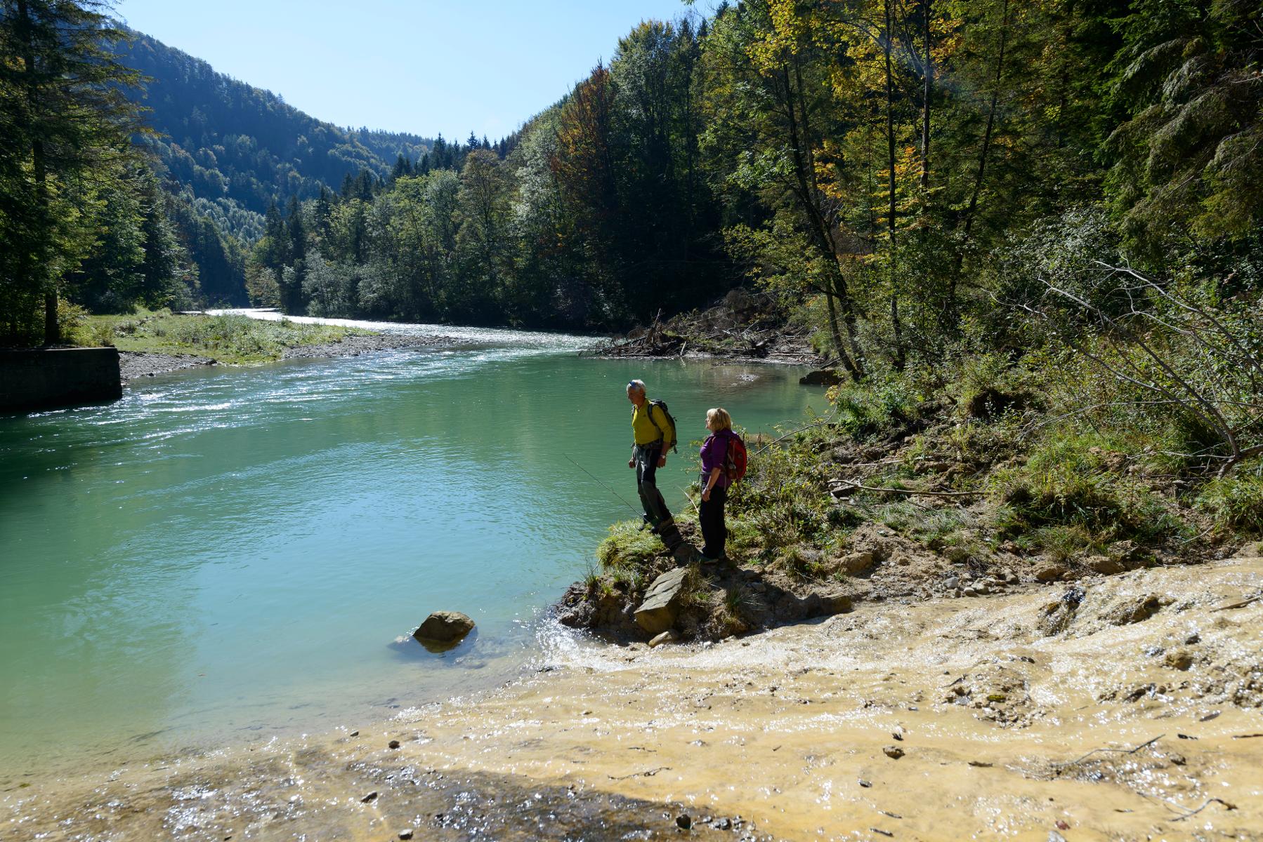
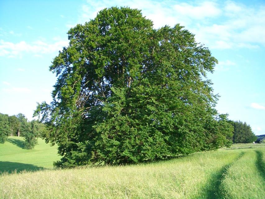
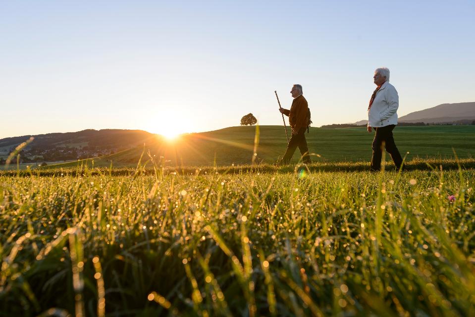
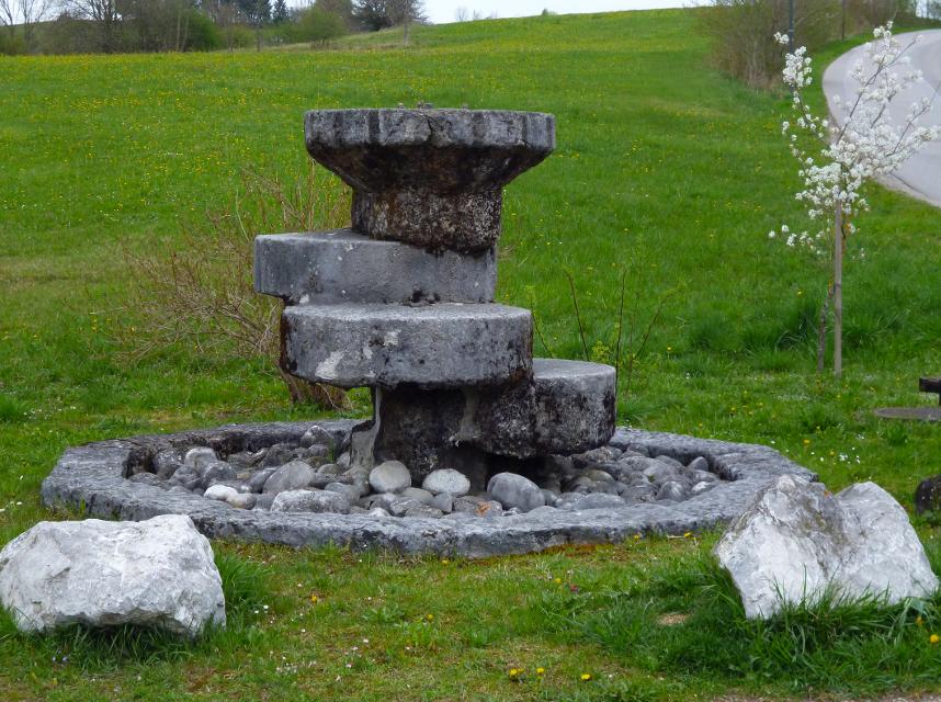
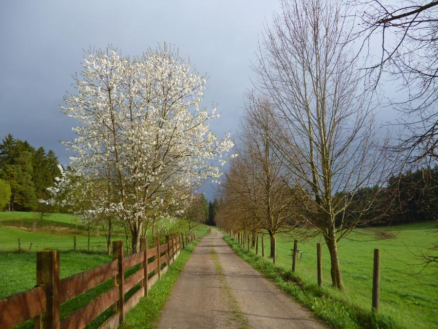
Benannt nach dem bekannten Münchner Maler Carl Spitzweg, der 1833 bei einem Kuraufenthalt im ehemaligen Bad Sulz den Entschluss fasste, Maler zu werden, führt die kleine Rundwanderung auf romantischen Wegen durch den Wald westlich von Peißenberg. Er ist ausgeschildert mit der Nr. 75 auf grünem Untergrund.
-
Aufstieg: 183 hm
-
Abstieg: 183 hm
-
Länge der Tour: 2,3 km
-
Höchster Punkt: 761 m
-
Differenz: 162 hm
-
Niedrigster Punkt: 599 m
Schwierigkeit
sehr leicht
Kondition
leicht
Panoramablick
mittel
Saisonale Eignung
-
JAN
-
FEB
-
MRZ
-
APR
-
MAI
-
JUN
-
JUL
-
AUG
-
SEP
-
OKT
-
NOV
-
DEZ
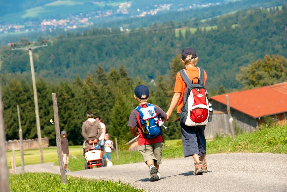
Merkmale Touren
Rundweg
Familientauglichkeit
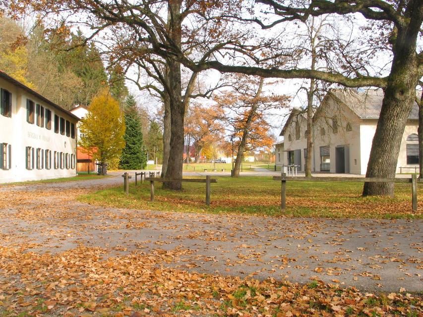
Parkplatz an der Tiefstollenhalle
aus Richtung Osten: Auf der A95 bis zur Ausfahrt Sindelsdorf, weiter über die B472 nach Peißenberg.
In der Ortsmitte in die Sulzer Straße einbiegen. Circa 200m der Straße bergauf folgen und dann erneut links zum Tiefstollen abbiegen. Dort befinden sich Parkplätze.
Mit öffentlichen Verkehrsmitteln: Für Bahnreisende: Vom Bahnhof ausgehend gehen Sie links (nördlich) in die Bergwerksstraße, welcher Sie circa 150m lang folgen. An der Kreuzung links in die Sulzer Straße einbiegen und der Straße circa 200m bergauf folgen. Dann wieder links abbiegen zum Tiefstollen. Dort beginnt und Endet der Spitzweg-Wanderweg. Ab hier bitte der Beschilderung folgen.
Nähere Informationen zur BRB - Bayerische Regiobahn finden Sie hier.
Weitere Informationen zur Werdenfelsbahn der DB finden Sie hier.
Startpunkt: Parkplatz an der Tiefstollenhalle Peißenberg
Ziel: Parkplatz an der Tiefstollenhalle Peißenberg
Navigieren zu


Hier befindet sich auch
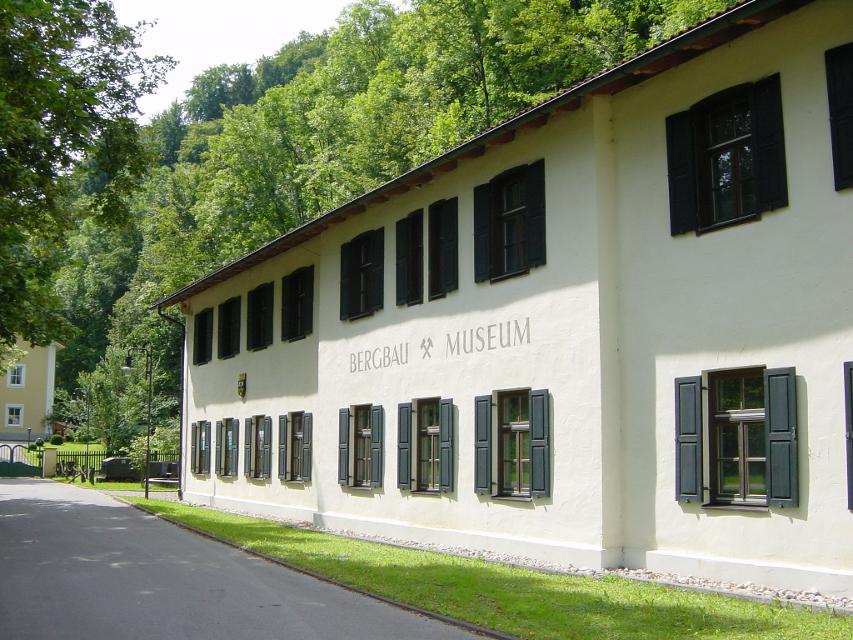
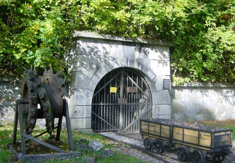
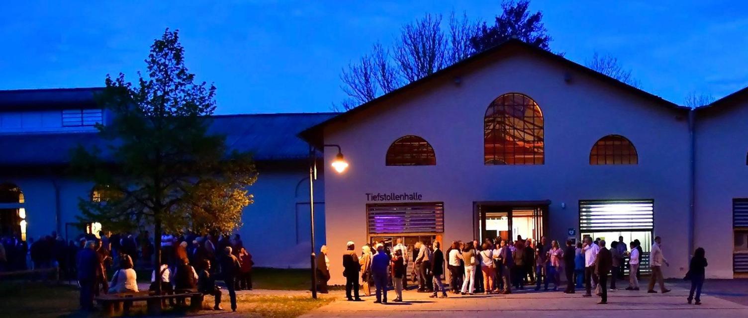
Bergbaumuseum Peißenberg
Am Tiefstollen 2, 82380 Peißenberg
Hier können Sie den Bergbau hautnah erleben! Das 1988 eröffnete Museum zeigt an drei Stationen die Geschichte des Peißenberger Bergbaus. Im Museum wird der Bergbau von der Entstehung der Kohle bis zur letzten Schicht 1971 erklärt. Der Erlebnisstollen, der früher 670 m in den Berg führte, vermittelt ein Gefühl von der Arbeit unter Tage. In der Großexponathalle findet man viele Ausstellungsstücke, die die technologische Entwicklung im Bergbau darlegen.

Essen in der Nähe
"Essen in der Nähe" überspringen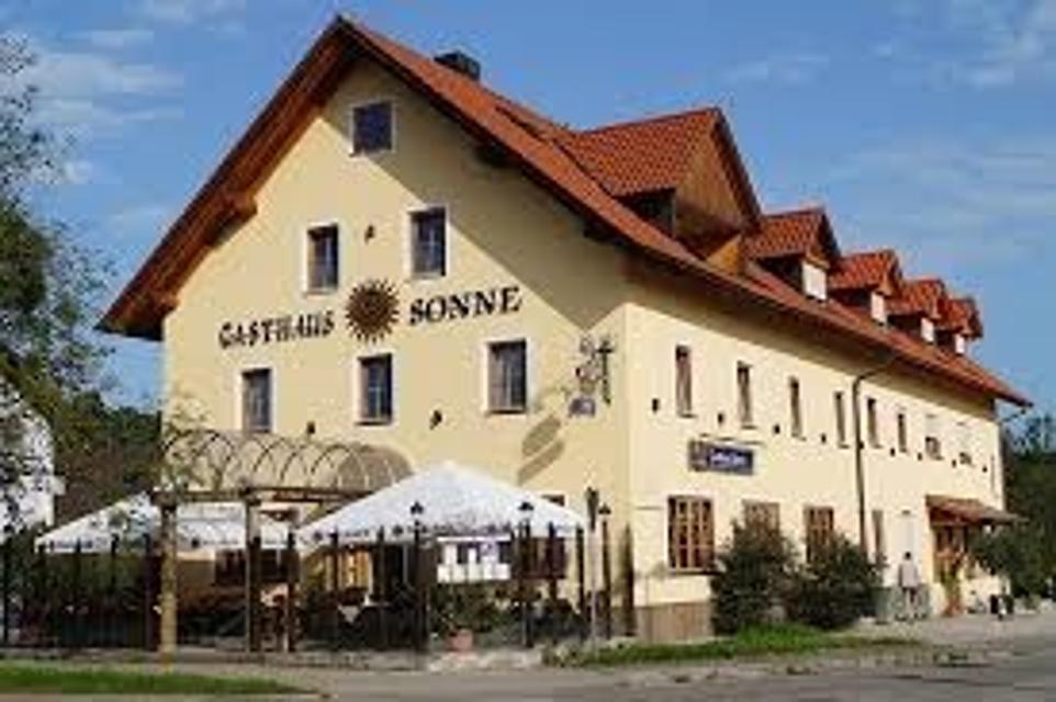
ca. 0,7 km entfernt
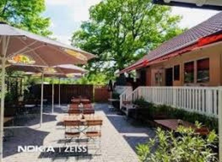
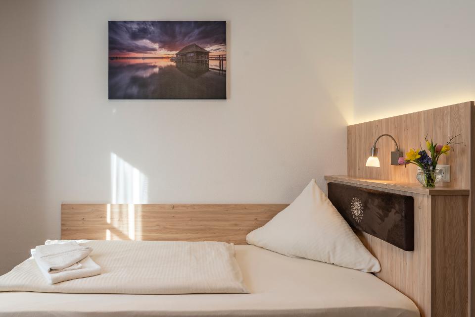
Gasthof Sonne
Hauptstraße 92, 82380 Peißenberg
Gemütliches Hotel und Gasthaus Sonne in Peißenberg südlich vom Ammersee. Moderne Zimmer, Restaurant, Natur
ca. 3,3 km entfernt
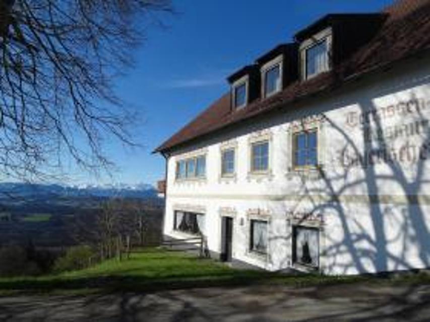
Gaststätte Bayerischer Rigi
M. Günther-Pl. 2, 82383 Hohenpeißenberg
Schweinshaxe, Jägerbraten und Staffelseezander im zünftigen Wirtshaus mit Panoramaterrasse auf 1000 m Höhe.
ca. 5,7 km entfernt
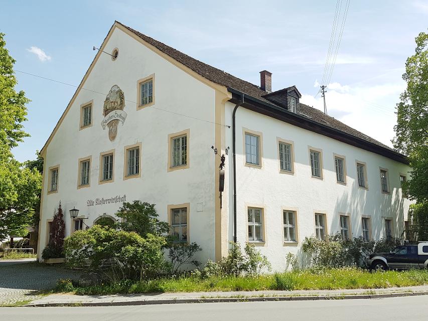
Klosterwirtschaft
Weilheimer Str. 12, 82398 Polling
Die Alte Klosterwirtschaft ist ein ideales Ausflugsziel im oberbayerischen Pfaffenwinkel.

ca. 5,9 km entfernt
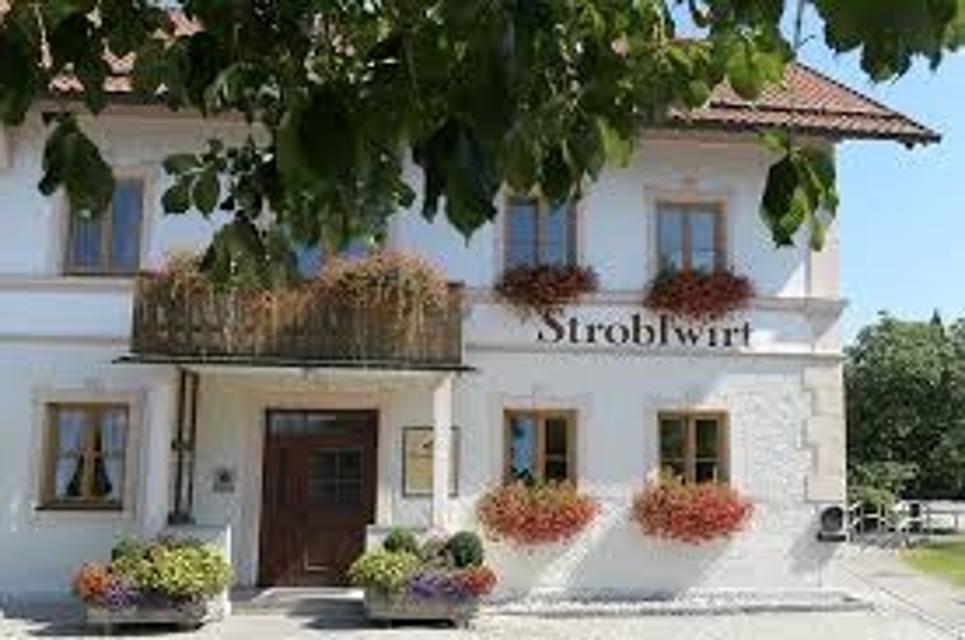
Gasthaus Strobl
Dorfstr. 6, 82386 Oberhausen
Ihr gemütliches Landgasthaus im Herzen des Pfaffenwinkels.
ca. 6,2 km entfernt
Trifthofstüberl
Trifthofstr. 57, 82362 Weilheim
In diesem gemütlichen und rustikalen Lokal wird Ihnen gutbürgerliche Küche serviert. In zwei getrennten Räumen ist Platz für bis zu 50 Personen. Am separaten Imbiss im separaten vorderen Bereich können Sie täglich (ausser Wochenende) ab 7.00-14:00 Uhr frisch zubereitete Speisen mitehmen.

ca. 6,3 km entfernt
ca. 7,4 km entfernt
Hotel Restaurant Pöltner Hof Weilheim
Pollinger Str. 4 & 6, 82362 Weilheim in Oberbayern
Die zentrale Lage im Zentrum von Weilheim und die schmackhafte Küche lockt Gäste von Nah und Fern in unser Restaurant. Reservieren Sie Ihren Tisch online.

ca. 7,7 km entfernt
Restaurant La Ruota
Kreuzgasse 10, 82362 Weilheim
Lassen Sie sich verwöhnen und genießen Sie Ihre Auszeit in Weilheim im Restaurant La Ruota.
ca. 7,7 km entfernt
Restaurant Korfu
Kreuzgasse 7, 82362 Weilheim
Griechisches Restaurant mit Biergarten in der Weilheimer Innenstadt.
Unterkünfte in der Nähe
"Unterkünfte in der Nähe" überspringen
ca. 0,4 km entfernt
Wohnmobilstellplatz Alte Bergehalde Peißenberg
Zur Alten Bergehalde 8, 82380 Peißenberg
Der neu eingerichtete Wohnmobilstellplatz "Alte Bergehalde" bietet nahezu Full-Service für wenig Geld.
ca. 2,3 km entfernt
ca. 4,1 km entfernt
Granerhof Ferien GbR
Grambacherweg 11, 82389 Böbing
Wir Rudolfs lieben das Landleben auf unserem Hof am Ortsteil Granerhof in Böbing. Sie suchen nach einem liebenswerten Bauernhof mit viel Ruhe? Dann schauen Sie doch bei uns vorbei! Erwachsene wie Kinder fühlen sich bei uns auf dem Hof wohl und es ist für jeden etwas auf unserem Bauernhof dabei.
ȚȚȚȚ
Weitere Tipps in der Nähe
"Weitere Tipps in der Nähe" überspringen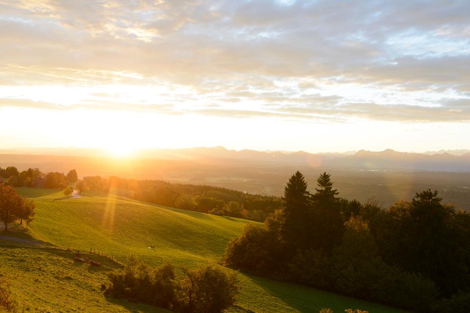
ca. 0,0 km entfernt
Knappensteig
Der Knappensteig verbindet den ausgeschilderten Stollenweg mit einer Besteigung des Hohen Peißenbergs, dem Panoramaberg im Pfaffenwinkel schlechthin. Entlang des mit zahlreichen Informationstafeln ausgestatteten Lehrpfads erfahren Wanderer interessante Details zum Bergbau rund um Peißenberg. Bei klarer Sicht reicht der Blick vom Hohen Peißenberg von den Chiemgauer Alpen über das Ester- und Wettersteingebirge bis zu den Ammergauer und Allgäuer Alpen. Beschildert: Nr. Nr. 83, rot
5:15 h 681 hm 681 hm 17,6 km sehr schwer
ca. 0,0 km entfernt
Winterwanderung - Knappensteig
Der Knappensteig verbindet den ausgeschilderten Stollenweg mit einer Besteigung des Hohen Peißenbergs, dem Panoramaberg im Pfaffenwinkel schlechthin. Entlang des mit zahlreichen Informationstafeln ausgestatteten Lehrpfads erfahren Wanderer interessante Details zum Bergbau rund um Peißenberg. Bei klarer Sicht reicht der Blick vom Hohen Peißenberg von den Chiemgauer Alpen über das Ester- und Wettersteingebirge bis zu den Ammergauer und Allgäuer Alpen. Beschildert: Nr. Nr. 83, rot
5:15 h 533 hm 533 hm 17,6 km sehr schwer
ca. 0,0 km entfernt
Stollenweg
Auf dem gut ausgeschilderten Stollenweg, ausgeschildert mti der Nr. 76 auf blauem Grund, bewegen sich Wanderer auf den Spuren des Bergbaus am Hohen Peißenberg, dessen Blütezeit mit dem Anschlag des Hauptstollens im Jahr 1837 begann. Insgesamt 15 Informationstafeln vermitteln entlang des Rundwegs interessante Details zum Pechkohleabbau und den Kohlevorkommen rund um Peißenberg sowie zur eiszeitlich geprägten Landschaft im Alpenvorland.
3:00 h 344 hm 344 hm 9,4 km mittel
ca. 0,0 km entfernt
Winterwanderung - Stollenweg
Auf dem gut ausgeschilderten Stollenweg, ausgeschildert mti der Nr. 76 auf blauem Grund, bewegen sich Wanderer auf den Spuren des Bergbaus am Hohen Peißenberg, dessen Blütezeit mit dem Anschlag des Hauptstollens im Jahr 1837 begann. Insgesamt 15 Informationstafeln vermitteln entlang des Rundwegs interessante Details zum Pechkohleabbau und den Kohlevorkommen rund um Peißenberg sowie zur eiszeitlich geprägten Landschaft im Alpenvorland.
3:00 h 313 hm 313 hm 9,4 km mittel
ca. 0,1 km entfernt
Winterwanderung - Auf den Hohen Peißenberg
Der Wanderweg zum Hohen Peißenberg ist eine anspruchsvolle Tour mit vielen Höhenmetern. Wenn der Berggipfel erreicht ist, wartet eine Vielzahl an Sehenswürdigkeiten und ein herrlicher Rundumblick auf erkundungsfreudige Wanderer. Die Wallfahrtskirche, das Observatorium und der Fernsehturm sind nur einige der Attraktionen. Für junge Wanderer ist der Wetterlehrpfad eine spannende Reise in die Welt des Klimas. Beschildert: Nr. 77, blau
3:30 h 380 hm 380 hm 10,7 km mittel

ca. 0,1 km entfernt
Wanderweg zum Hohen Peißenberg
Der Wanderweg zum Hohen Peißenberg ist eine anspruchsvolle Tour mit vielen Höhenmetern. Wenn der Berggipfel erreicht ist, wartet eine Vielzahl an Sehenswürdigkeiten und ein herrlicher Rundumblick auf erkundungsfreudige Wanderer. Die Wallfahrtskirche, das Observatorium und der Fernsehturm sind nur einige der Attraktionen. Für junge Wanderer ist der Wetterlehrpfad eine spannende Reise in die Welt des Klimas. Beschildert: Nr. 77, blau
3:15 h 381 hm 381 hm 10,7 km mittel
ca. 0,1 km entfernt
Bergbaumuseum Peißenberg
Am Tiefstollen 2, 82380 Peißenberg
Hier können Sie den Bergbau hautnah erleben! Das 1988 eröffnete Museum zeigt an drei Stationen die Geschichte des Peißenberger Bergbaus. Im Museum wird der Bergbau von der Entstehung der Kohle bis zur letzten Schicht 1971 erklärt. Der Erlebnisstollen, der früher 670 m in den Berg führte, vermittelt ein Gefühl von der Arbeit unter Tage. In der Großexponathalle findet man viele Ausstellungsstücke, die die technologische Entwicklung im Bergbau darlegen.

ca. 0,2 km entfernt

Radpilgern durch Pfaffenwinkel und Zuspitz Region: Stille Wege - Zwischen Staffelsee und Ammer
Mehr Entschleunigung geht nicht. Nicht einzelne Ziele sind der Reiz dieser Runde, es ist der Weg selbst: Einladende Pfade führen durch einsame Waldgebiete zu herrlichen Ausblicken - und in himmlische Ruhe.
4:40 h 611 hm 611 hm 59,1 km

ca. 0,2 km entfernt
Pfaffenwinkel-Panorama-Tour
Mit 988 Metern Höhe markiert der Hohe Peißenberg den schönsten Aussichtspunkt im Pfaffenwinkel.
6:55 h 1386 hm 1386 hm 123,0 km sehr schwer
ca. 0,2 km entfernt

Radpilgern durch Pfaffenwinkel und Zugspitz Region: Weitblicke - Vom Hohen Peißenberg zu spiegelnden Wassern
Diese Runde ist der Himmel. Ihm kommt man ganz nah auf dem Hohen Peißenberg mit seiner über 500 Jahre alten Wallfahrtskirche und einem der schönsten Rundblicke Bayerns.
7:00 h 931 hm 931 hm 94,9 km
ca. 0,2 km entfernt
Schäfflerweg
Der Schäfflerweg ist eine wunderschöne Wanderrunde mit Start in Peißenberg, der Marktgemeinde des lebendig gebliebenen Bergbaus.
3:15 h 235 hm 235 hm 10,7 km mittel
ca. 0,3 km entfernt

Radpilgern durch Pfaffenwinkel und Zugspitz Region: Wilde Flüsse - zwischen Auerberg und Hohem Peißenberg
Diese Runde vereint alles, was den Pfaffenwinkel so anziehend macht: Barocke Pracht und ländliches Leben, Wege nach innen und atemberaubende Fernblicke, Kulturland mit Geschichte und nahezu unberührte Natur.
7:25 h 1004 hm 1004 hm 98,2 km

Das könnte Dir auch gefallen
"Das könnte Dir auch gefallen" überspringen
Große Frechensee-Runde
Auf der gemütlichen Runde genießen Spaziergänger die Ruhe und Natur in den wunderschönen Mischwäldern südlich von Seeshaupt. Auch wenn der idyllisch gelegene Frechensee nur auf seiner unzugänglichen Ostseite passiert wird, bieten sich immer wieder reizvolle Blicke auf den grün-blau schimmernden See. Beschildert: Nr. 33, blau
1:30 h 52 hm 52 hm 5,5 km sehr leicht
Haselbachrunde
Der Haselbachweg ist zu jeder Jahreszeit einer der schönsten und abwechslungsreichsten Rundwanderwege. Im Frühjahr blühen hunderte Märzenbecher am Bachlauf und Mehlprimeln stehen in den Streuwiesen. Im Sommer blühen Orchideen und viele andere Wildblumen. Der Herbst begeistert mit Lungen-, Schwalbenwurz- und Moorenzian. Im Winter wird ein Teil des Weges als Langlaufloipe gespurt. Ein besonderes Erlebnis ist es, den Haselbachweg bei glänzendem Schnee und Sonnenschein mit Schneeschuhen zu durchwandern.
1:25 h 35 hm 34 hm 5,6 km sehr leicht
Kleine Frechensee-Runde
Die gemütliche Spazierrunde führt einmal rund um den idyllisch inmitten von wunderschönen Mischwäldern gelegenen Frechensee. An seinem Westufer genießen Spazieränger auf einer großen Lichtung mit saftig grünen Wiesen die nahezu unberührte Natur und wohltuende Ruhe fernab der Zivilisation. Beschildert: Nr. 32, blau
1:15 h 59 hm 59 hm 4,7 km sehr leicht
Großer Ostersee-Rundweg
Die Umrundung des Großen Ostersees ist eine landschaftlich einzigartige Wanderung durch eine der größten und vielfältigsten Eiszerfallslandschaften des bayerischen Alpenvorlands. Romantische Mischwälder und Moorgebiete, idyllische Buchten und traumhafte Ausblicke über den blau-grün schimmernden See bis hin zu den Bayerischen Alpen sorgen für ein eindrucksvolles Naturerlebnis. Beschildert: Nr. 25, blau
2:45 h 107 hm 107 hm 10,5 km mittel
Penzberger Berghaldenpfad
In den vielen Jahren des Bergbaus in Penzberg entstand aus Abraumgestein die 70 Meter hohe Berghalde. Von der wahrscheinlich schönsten Aussichtsterrasse Penzbergs hat man einen fabelhaften Ausblick auf die Alpen und auf das weitläufige Loisach-Kochelseemoos. Der Natur-Erlebnis-Pfad ist als Rundweg über das vielfältige Freizeit- und Naherholungsgebiet der Berghalde angelegt.
1:00 h 61 hm 61 hm 2,8 km sehr leicht
Schnalz-Panoramaweg Böbing
Abwechslungsreicher könnte der bergige Rundweg kaum sein. Gut ausgebaute Panoramastrecken bieten am Anfang und Ende viel Zeit zum Schauen und Genießen. Dazwischen erwarten Wanderer mitunter steile Wurzel- und Treppenpfade durch den Wald, die bis hinunter an die Ammer und bis hinauf auf den Schnalz-Gipfel (901 m) führen. Beschildert: Nr. 89, blau
2:30 h 350 hm 350 hm 7,7 km mittel
Sonnenbichl-Weg
Der Sonnenbichl-Weg ist eine erstklassige Panoramarunde. Bis auf wenige Abschnitte werden Spaziergänger auf der gesamten Strecke von einem grandiosen Bergblick begleitet. Vom Aussichtspunkt in Geigersau, der nicht umsonst Dreiseenblick genannt wird, eröffnet sich ein eindrucksvoller Blick nach Norden bzw. Osten auf Ammersee, Starnberger See und Staffelsee. Beschildert: Nr. 93, blau
2:30 h 175 hm 151 hm 10,0 km mittel
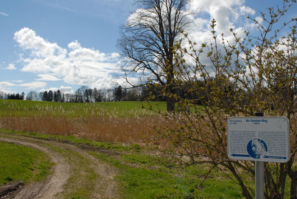
Doktor-Faustus-Weg
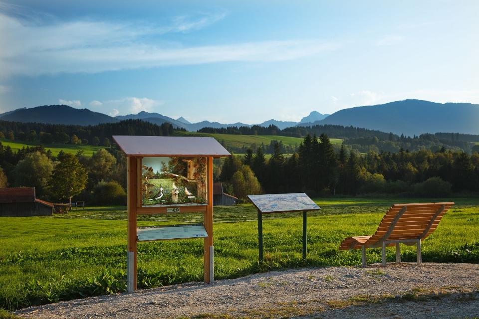
Der Doktor-Faustus-Weg wurde nach den Ortsbeschreibungen im Roman angelegt, die durch Thomas und Viktor Mann eindeutig für Polling verbürgt sind. Der landschaftlich reizvolle Rundweg berührt alle Orte, die Thomas Mann im Zusammenhang mit Geburts- und Wohnort seiner Titelfigur Adrian Leverkühn erwähnt. Man wandert auf den Spuren eines bedeutenden Werkes der Weltliteratur - im Spannungsfeld zwischen Realität und Kunstfigur. Mit 13 Texttafeln bietet der Themenweg unterhaltsame Erholung in intakter Kulturlandschaft.
1:30 h 60 hm 60 hm 4,6 km sehr leicht
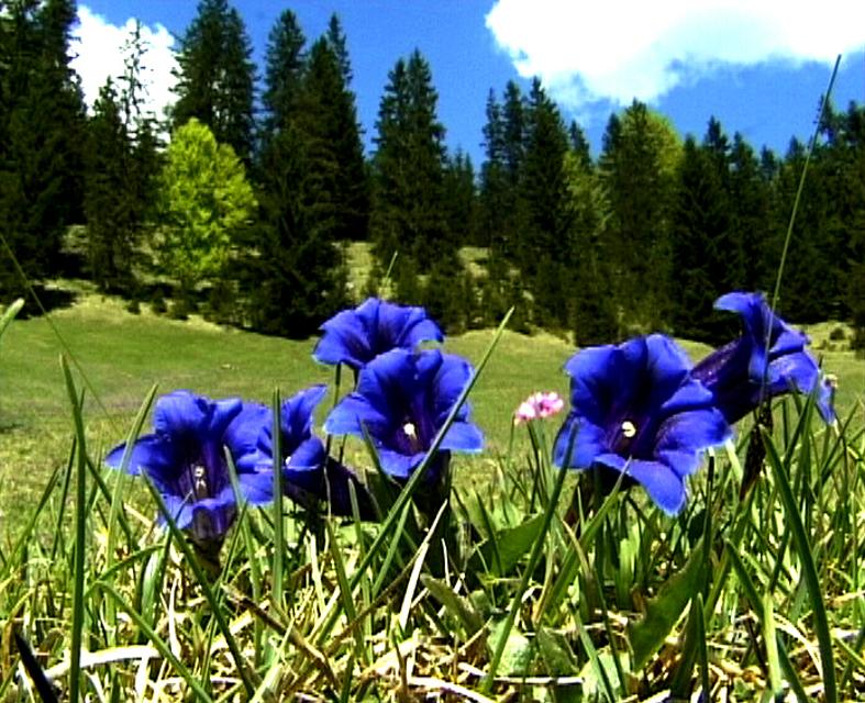
Enzianweg
Der landschaftlich reizvolle Rundweg hat allerlei Abwechslung zu bieten: weitläufige Wiesen, Felder und Moore, ein idyllisch gelegener See, ein erfrischender Badeweiher, zwei malerische Kapellen und nicht zuletzt ein fantastisches Bergpanorama. So geht es auf ruhigen, größtenteils asphaltierten Wegen genussvoll durch die wunderschöne Landschaft nordöstlich von Obersöchering. Beschildert: Nr. 11, blau
2:00 h 22 hm 22 hm 8,5 km sehr leicht
Hardtrunde (kurz)
Die kurze Version der Hardtrunde streift die typische Hardtlandschaft östlich von Weilheim nur am Rande. Im Zentrum steht vielmehr das sanfte Hügelland rund um den idyllischen Dietlhofer See, einem beliebten Badesee im Norden von Weilheim. Immer wieder genießen Spaziergänger wunderschöne Ausblicke auf den See und den Weiler Dietlhofen. Beschildert: Nr. 42, grün
1:00 h 47 hm 47 hm 3,9 km sehr leicht
Illach-Rundweg
Der flache Rundweg nahe der Illach führt Wanderer durch die weitläufige Landschaft des Pfaffenwinkels. Während Kulturinteressierte in Steingaden die Spuren der Welfendynastie erforschen können, ist für Naturliebhaber der türkisfarbene Lechstausee eine wunderbare Sehenswürdigkeit. Ausgeschildert mit der Nr. 120, rot.
2:30 h 154 hm 154 hm 9,4 km mittel
Königssträßle-Rundweg
Die panoramareiche Runde führt auf ruhigen Wegen durch die hügelige Voralpenlandschaft des südlichen Pfaffenwinkels. Grandiose Bergblicke und die weit über die Grenzen Bayerns hinaus bekannte Wieskirche ziehen Spaziergänger in ihren Bann. Beschildert: Nr. 117, blau
2:30 h 173 hm 173 hm 9,8 km mittel
Lanzenbachweg
Idyllisch führt die Runde, die auf den Schildern mit der Nr. 8 auf blauem Grund zu finden ist, in stetem Auf und Ab durch die Wald- und Wiesenlandschaft östlich des Pollinger Weihers. Immer wieder genießen Spaziergänger traumhafte Ausblicke auf die Alpenkette. Im Reinthaler Bauernhofmuseum können allerlei alte landwirtschaftliche Geräte bestaunt werden. Direkt nebenan lohnt sich eine Einkehr im dazugehörigen Café. Beschildert: Nr. 8, blau
2:15 h 128 hm 128 hm 8,6 km mittel
Lauterbach-Rundweg
In Steingaden beginnt der Rundweg nach Lauterbach. Vom Startpunkt führt der Weg über wenig befahrene Sträßchen und Forstwege nordöstlich von Steingaden. Ein Begleiter der Tour ist der grandiose Weitblick auf die Alpen und auf das Welfenmünster. Ausgeschildert ist der Weg mit der Nr. 119, blau.
2:15 h 142 hm 142 hm 7,3 km mittel
Moor- und Drumlinrunde Eberfing
Die ausgedehnte Spazierrunde bei Stadel ist eine Runde durch die weitläufigen Filzgebiete und romantische Wälder im bayerischen Oberland nahe des Starnberger Sees. Auf der Rundwanderung darf man die sanfte Hügellandschaft im malerischen Voralpenland kenne lernen. Der Stadler Weiher ist das Highlight der Tour und einen Abstecher für einen Sprung in das kühle Nass wert. Beschildert: T16, blau
2:30 h 60 hm 58 hm 8,2 km mittel
Panoramaweg Schellenberg
Der Panoramaweg über den Schellenberg wird seinem Namen mehr als gerecht. Schon vom Weg aus, erst recht aber auf dem Schellenberg genießen Spaziergänger einen fantastischen Blick auf die Alpen und den Hohen Peißenberg. Beschildert: Nr. 17, grün
1:00 h 48 hm 48 hm 4,1 km sehr leicht
Schäfflerweg
Der Schäfflerweg ist eine wunderschöne Wanderrunde mit Start in Peißenberg, der Marktgemeinde des lebendig gebliebenen Bergbaus.
3:15 h 235 hm 235 hm 10,7 km mittel
Schnalz-Panoramaweg Peiting
Abwechslung und Spannung ist auf dem ausgedehnten Rundweg garantiert. Zwischen saftig grünen Wiesen und schattigen Wäldern führt er bis an die wildromantische Ammer hinunter, wo mit dem Ammerlauf-Lehrpfad noch eine informative Extra-Runde gedreht wird. Auf dem Weg in Richtung Schnalz-Gipfel stellen die unzähligen Stufen einen echten Konditionstest dar. ‘Beschildert: Nr. 101, blau
3:30 h 412 hm 412 hm 10,2 km mittel
Seewiesenweg
Die gemütliche Spazierrunde ist zwar kurz, aber dafür umso abwechslungsreicher. Begleitet von einem traumhaften Alpenpanorama führt der Weg nach Huglfing, bevor es durch die einzigartige Grasleitner Moorlandschaft zurück nach Oberhausen geht. Beschildert: Nr. 63, grün
1:00 h 47 hm 47 hm 4,0 km sehr leicht
Storchenweg
Auf dem kurzen, flachen Rundweg genießen Spaziergänger über den freien Felder und Wiesen nordöstlich von Raisting ein traumhaftes Bergpanorama. Wer im Frühling oder Frühsommer unterwegs ist, kann mit etwas Glück häufig Störche beobachten, die während dieser Zeit in einem der zahlreichen Horste in und um den Ort nisten. Beschildert: Nr. 50, grün
1:00 h 22 hm 22 hm 4,1 km sehr leicht
Vogellehrpfad Bad Bayersoien
Auf 6 informativen Schautafeln entlang diesen Themenweges erfahren Sie alles über die reiche Vogelwelt am Soier See. Mit einem speziellen "TING"-Stift lassen Sie die Vogelwelt auch erklingen. Diesen "TING"-Stift können Sie sich in der Tourist-Information in Bad Bayersoien und im Fischerhäusl am Soier See gegen Pfand kostenlos aussleihen.
0:31 h 15 hm 15 hm 2,1 km sehr leicht
Wald-Wanderweg
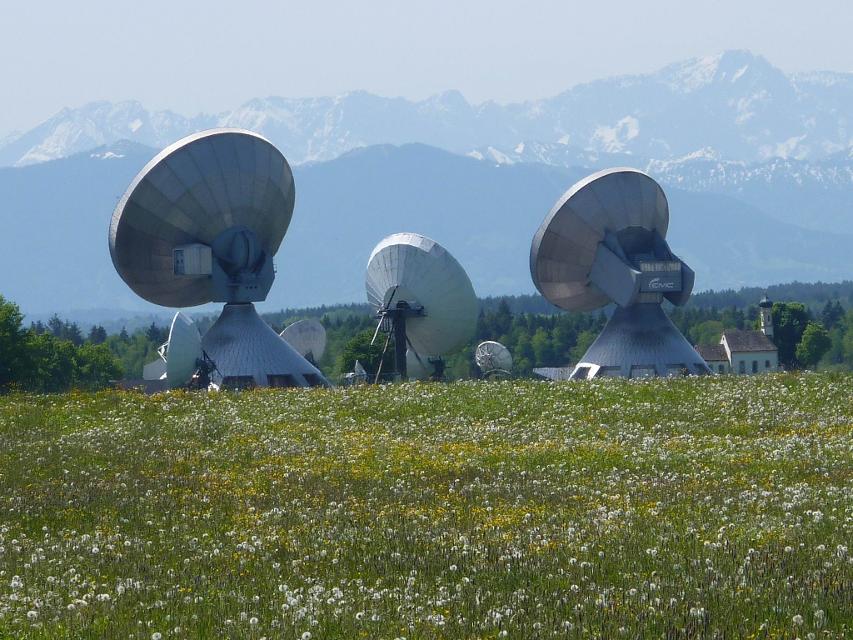
Der Wald-Wanderweg führt uns auf ruhigen Forstwegen durch idyllische Wälder. Die gemütliche Runde führt um die Ortschaft Raisting, die für ihre Erdfunkstelle große Bekanntheit genießt. Die weit sichtbaren Parabolantennen sind ein Wahrzeichen des Weilheimer Landes. Beschildert: Nr. 53, blau
1:30 h 64 hm 64 hm 6,8 km mittel
Bergwetter-Weg
In exponierter Lage führt die Spazierrunde auf gut beschilderten Wegen zu den spannenden Sehenswürdigkeiten des Hohen Peißenbergs. Auf der Runde erwartet uns die älteste Bergwetterstation der Erde, eine Entdeckungsreise durch die Welt des Klimas und die Wallfahrtskirche Maria Himmelfahrt. Beschildert: Nr. 82, blau
1:30 h 196 hm 196 hm 4,8 km sehr leicht
Erdfunkstellen-Wanderweg
Die eindrucksvolle, durchaus außergewöhnliche Spazierrunde führt einmal rund um die schon von Weitem sichtbare Erdfunkstelle südlich von Raisting. Mitten auf der grünen Wiese stehen hier riesige Antennen, welche bis heute für internationale Satellitenverbindungen und damit für weltweite Kommunikation genutzt werden. Beschildert: T51, grün
1:15 h 22 hm 22 hm 5,0 km sehr leicht
Hardtrunde (lang)
Die ausgedehnte Runde führt über weite Strecken durch die einzigartige Hardtlandschaft mit Hoch- und Niedermooren, Magerrasen- und Streuwiesengebieten sowie weitläufigen Wäldern. Auf dem landschaftlich äußerst reizvollen Weg über kaum befahrene Sträßchen und ruhige Forstwege genießen Spaziergänger immer wieder traumhafte Ausblicke auf die Alpenkette. Beschildert: Nr. 44, rot
2:30 h 109 hm 109 hm 9,6 km mittel
Hardtrunde (mittel)
Die landschaftlich reizvolle Hardtrunde führt in ihrem östlichen Teil durch die wunderschöne, äußerst vielfältige Hardtlandschaft. Saftig grüne Wiesen wechseln sich immer wieder mit weitläufigen Wald- und Moorgebieten ab. Im Gegensatz dazu ist der westliche Teil der Runde geprägt durch die weiten, häufig landwirtschaftlich genutzten Felder und Wiesen rund um den Dietlhofer See, der sich im Sommer hervorragend zum Baden eignet. Beschildert: Nr. 43, blau
2:00 h 88 hm 88 hm 7,1 km sehr leicht
Kirchen-Rundweg Iffeldorf
Das Ziel des kurzen Rundwegs ist die Wallfahrtskirche St. Maria im Heuwinkl. Die als Heuwinklkapelle bekannte Kirche liegt wunderschön auf einer Anhöhe östlich von Iffeldorf. Sie gilt als eine der schönsten Kapellen im gesamten bayerischen Oberland. Durch ihre exponierte Lage und ihren originellen runden Bau mit der großen roten Kuppel ist sie schon von Weitem sichtbar. Beschildert: Nr. 24, grün
0:45 h 39 hm 39 hm 2,8 km sehr leicht