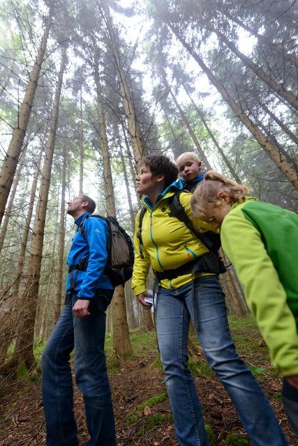
Besonders geeignet für:


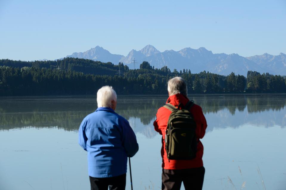


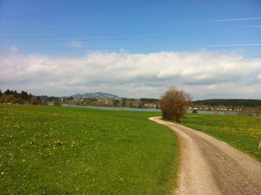

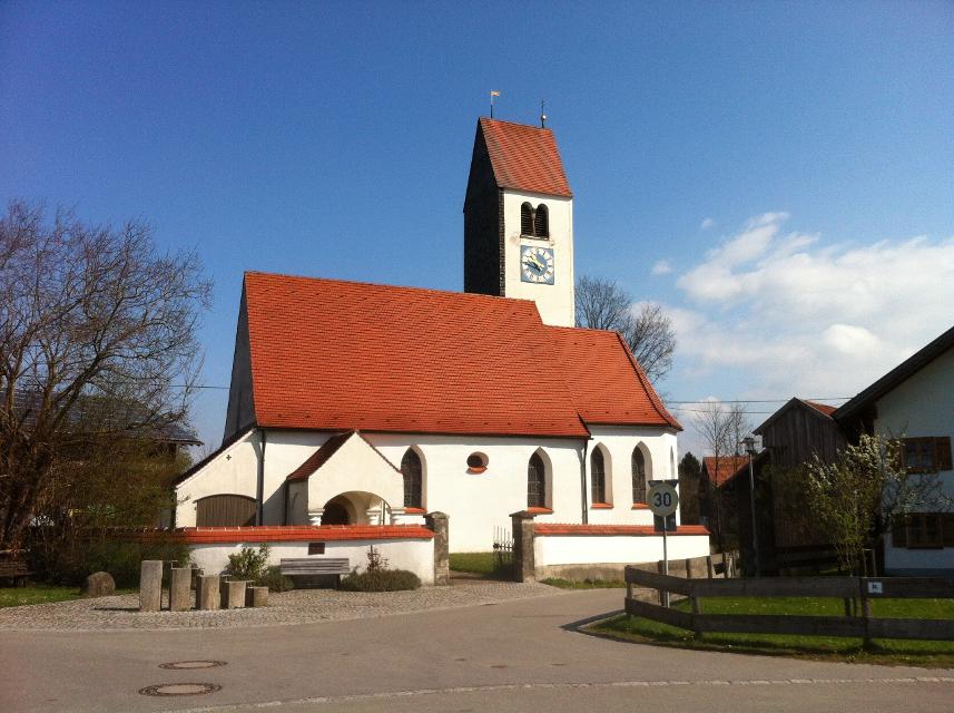

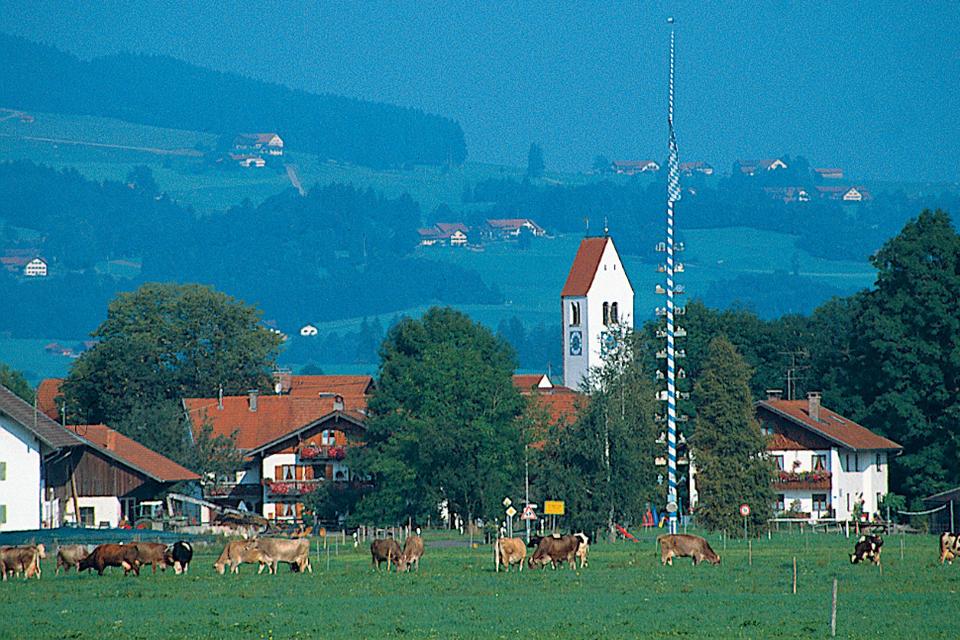
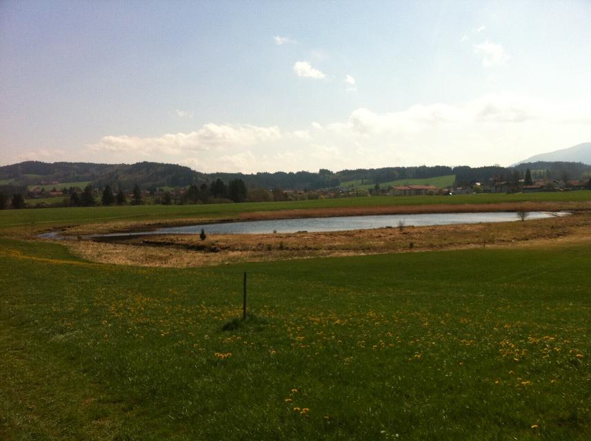
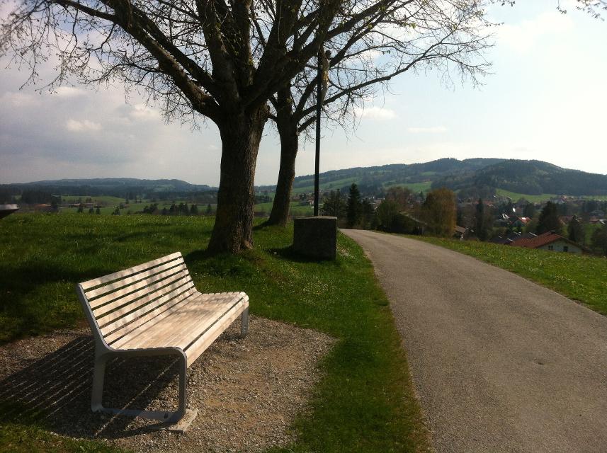
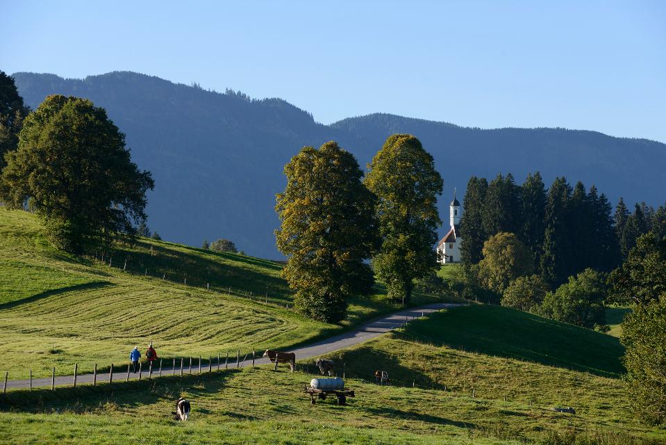
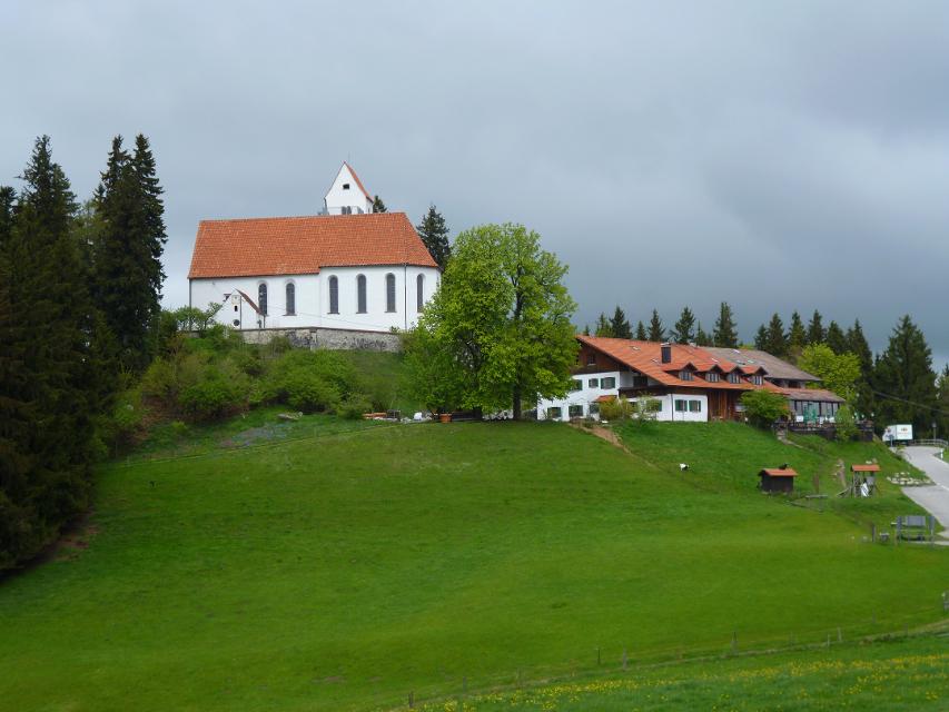
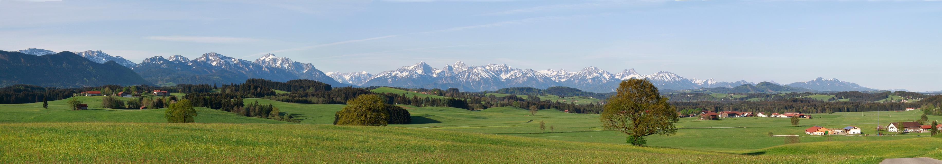
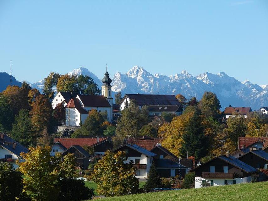
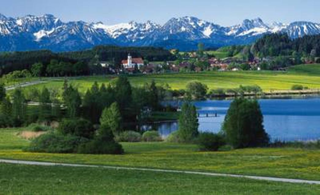
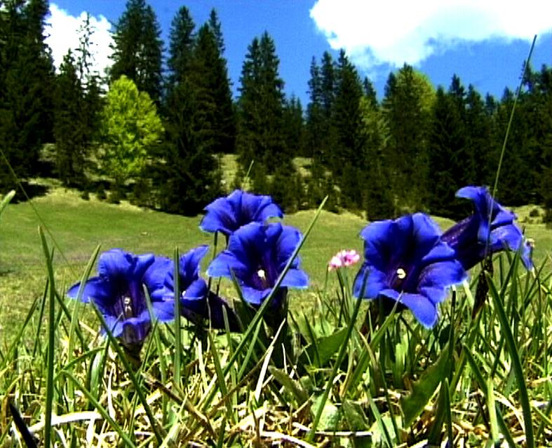
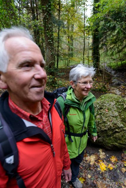
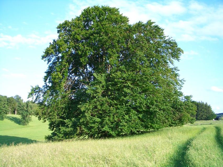
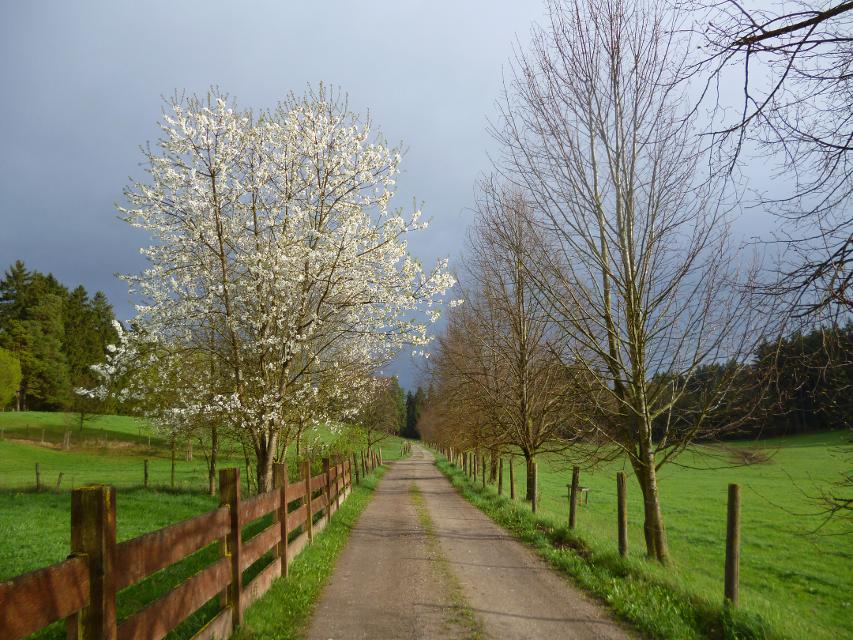
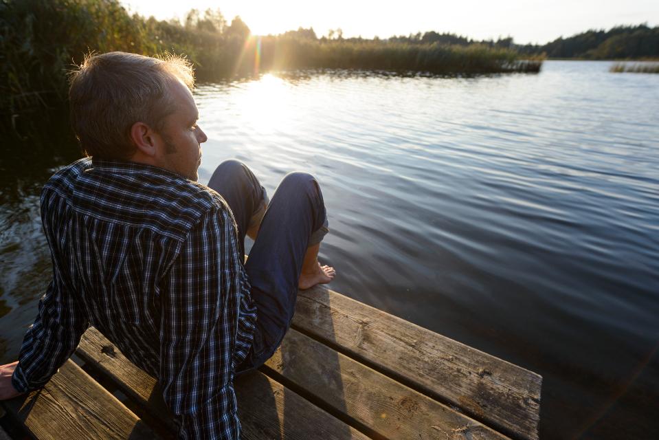
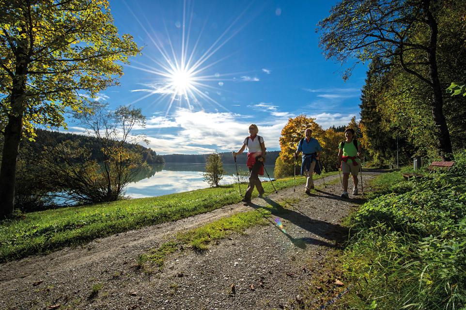
Die Panoramarunde führt uns von Steingaden zum Lechstausee. Sobald wir Steingaden verlassen haben und den Storchenmoosweiher passiert haben, öffnet sich uns ein gigantisches Alpenpanorama, das uns bis zum Ausgangspunkt zurück begleiten wird.
Beschildert: Nr. 115, blau
-
Aufstieg: 95 hm
-
Abstieg: 92 hm
-
Länge der Tour: 7,6 km
-
Höchster Punkt: 794 m
-
Differenz: 71 hm
-
Niedrigster Punkt: 723 m
Schwierigkeit
mittel
Kondition
mittel
Panoramablick
viel
Saisonale Eignung
-
JAN
-
FEB
-
MRZ
-
APR
-
MAI
-
JUN
-
JUL
-
AUG
-
SEP
-
OKT
-
NOV
-
DEZ
Merkmale Touren
Aussichtsreich
Kinderwagentauglich
Rundweg
Einkehrmöglichkeit
Familientauglichkeit
Öffentlicher Wanderparkplatz in der Kissinger Straße in Steingaden.
Mit öffentlichen Verkehrsmitteln: Mit dem Zug nach Weilheim in Oberbayern oder Füssen im Allgäu, von dort mit dem Bus nach Steingaden.
Startpunkt: Wandertafel vor Tourist Information
Ziel: Wandertafel vor Tourist Information
Navigieren zu


Hier befindet sich auch
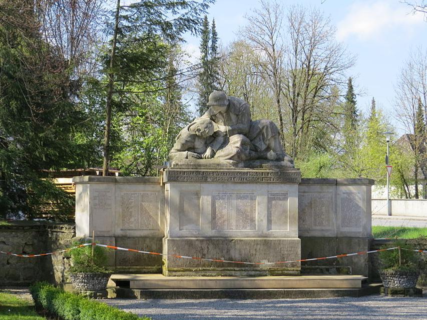
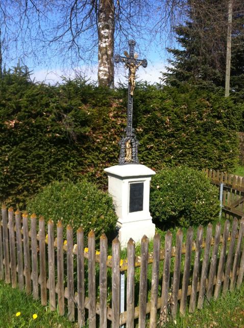
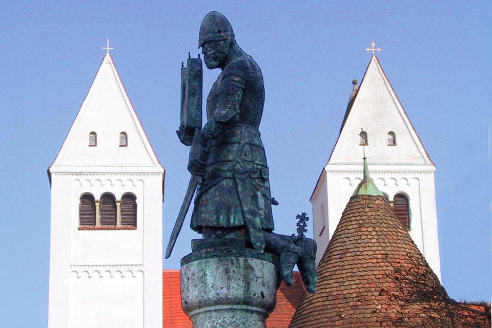
Kriegerdenkmal Steingaden
Marktplatz 2, 86989 Steingaden
Kriegerdenkmal zur Erinnerung gefallener Soldaten im Ersten Weltkrieg.


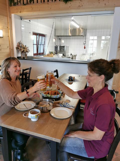
Essen in der Nähe
"Essen in der Nähe" überspringen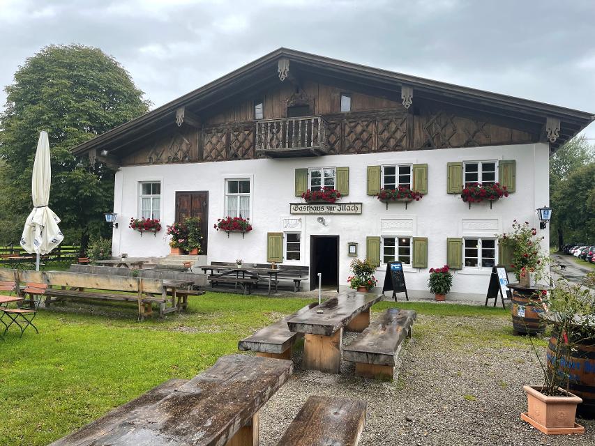
ca. 2,3 km entfernt
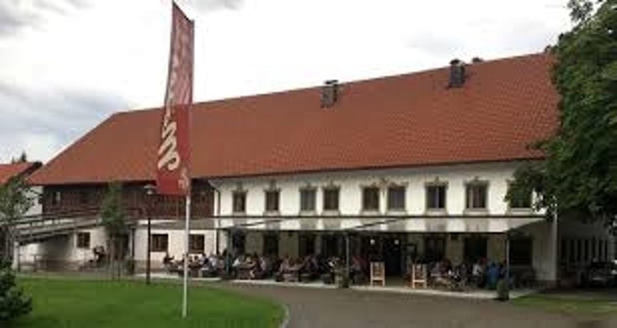
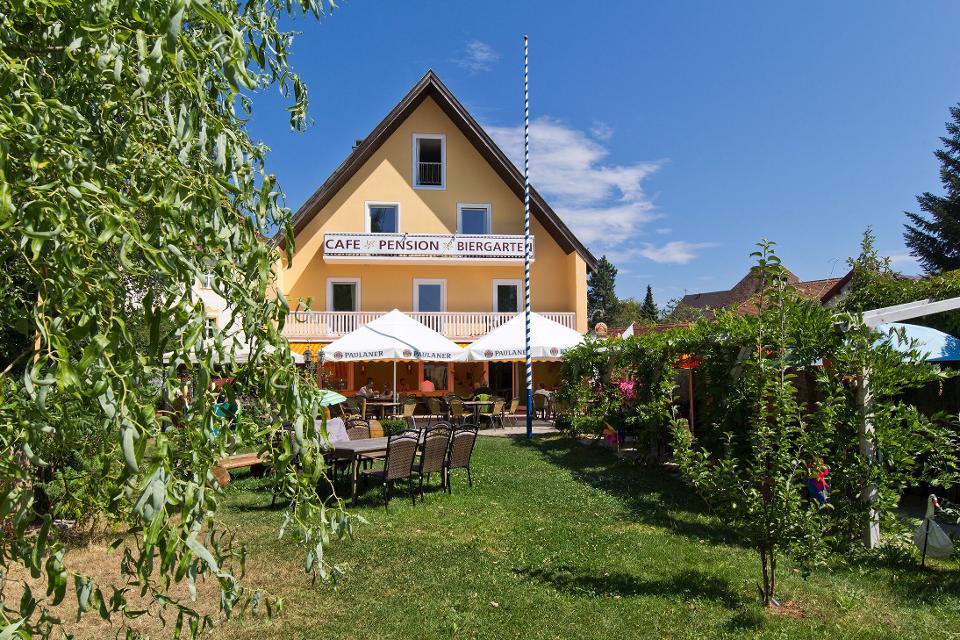
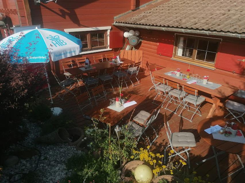
Gasthaus zur Illach
Illach 1, 86989 Steingaden
Uriger und schöner Biergarten direkt an der Illach bei Steingaden

ca. 5,2 km entfernt
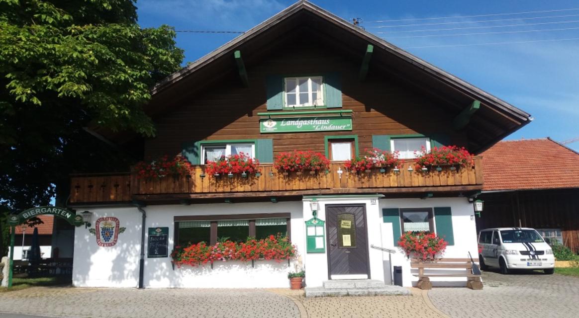
Magdalena
Obere Dorfstraße 23, 86984 Prem
Ein wunderschöner Blumenladen mit einem recht großen Café lädt zum Verweilen und Genießen ein.

ca. 7,5 km entfernt
ca. 8,1 km entfernt
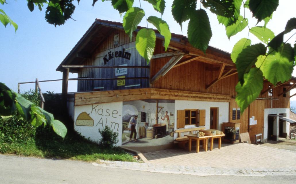
Schönegger Käsealm
Schönegg 6, 82401 Rottenbuch
Die Schönegger Käse-Alm ist nicht nur eine Station des Pfaffenwinkler Milchweges, sondern der Ort, an dem reine Heumilch aus der Region zu Käse verarbeitet wird. In der Schaukäserei können Interessierte den Prozess der Käseherstellung dienstags und donnerstags verfolgen und die fertigen Produkte anschließen im Verkauf erwerben. Für Hungrige gibt es Leckereien, die in der Brotzeitstube und im Biergarten verzehrt werden können. Ein Highlight für Kinder ist der Streichelzoo, der neben dem Spielplatz und dem Kräutergarten auf der Käse-Alm einen festen Platz eingenommen hat.

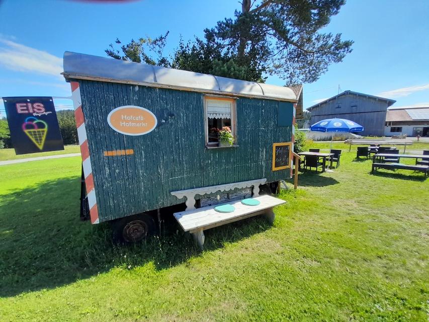
ca. 8,7 km entfernt
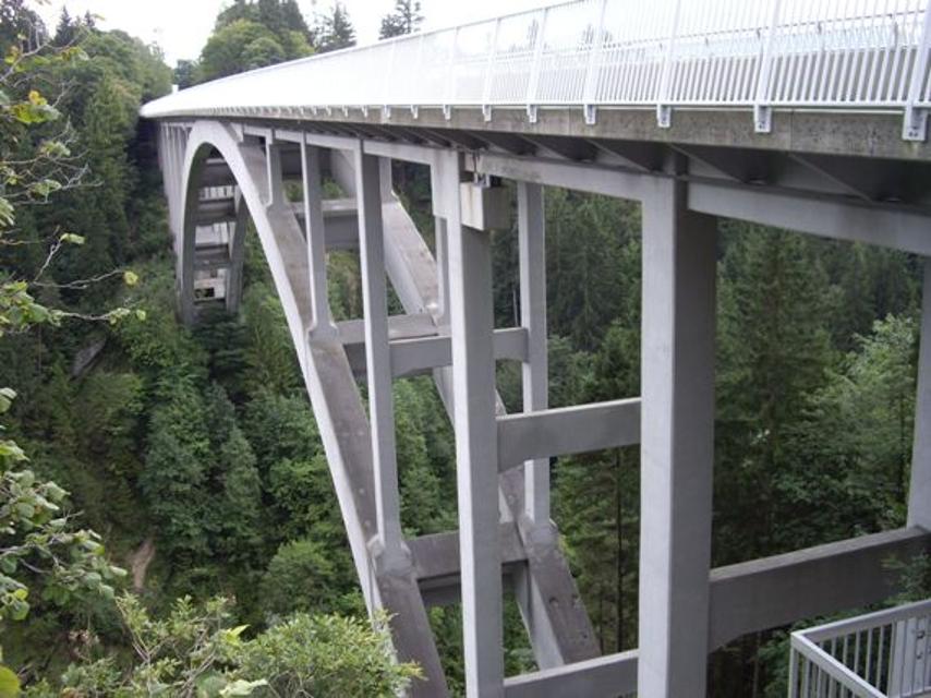
Kiosk an der Echelsbacher Brücke „ Hänsl & Gretls Brückenschmiede“
Achen 11, 82401 Rottenbuch
Unterkünfte in der Nähe
"Unterkünfte in der Nähe" überspringen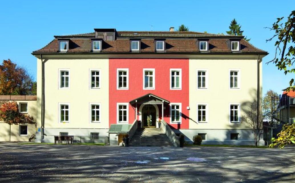

ca. 2,2 km entfernt
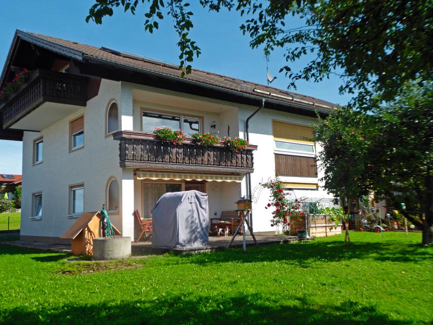
Wohnmobilstellplatz auf dem Ferienhof Steingaden
Maderbichl 4, 86989 Steingaden

Weitere Tipps in der Nähe
"Weitere Tipps in der Nähe" überspringen
ca. 0,0 km entfernt
Kriegerdenkmal Steingaden
Marktplatz 2, 86989 Steingaden
Kriegerdenkmal zur Erinnerung gefallener Soldaten im Ersten Weltkrieg.
ca. 0,0 km entfernt
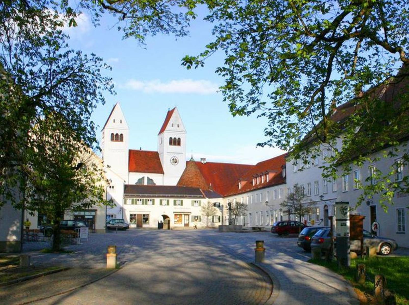
Tourist Information Steingaden
Krankenhausstraße 2, 86899 Steingaden
Herzlich Willkommen in Steingaden!
ca. 0,0 km entfernt
ca. 0,0 km entfernt
Reitersau-Rundweg
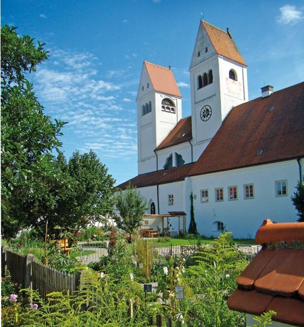
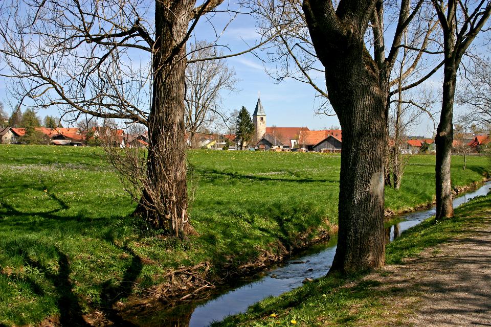
Auf dem ruhigen Rundweg durchstreifen Spaziergänger die sanfte Hügellandschaft südlich von Steingaden. Das Welfenmünster in dem ehemaligen Klosterdorf gilt als eine der bedeutendsten Sehenswürdigkeiten im gesamten Pfaffenwinkel. Beschildert mit der Nr. 121, blau
1:30 h 111 hm 111 hm 6,7 km sehr leicht
ca. 0,0 km entfernt
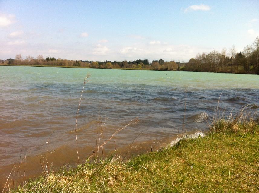
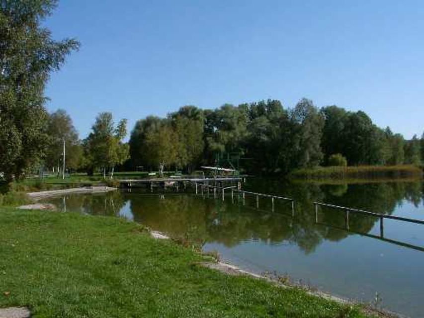
Illach-Rundweg
Der flache Rundweg nahe der Illach führt Wanderer durch die weitläufige Landschaft des Pfaffenwinkels. Während Kulturinteressierte in Steingaden die Spuren der Welfendynastie erforschen können, ist für Naturliebhaber der türkisfarbene Lechstausee eine wunderbare Sehenswürdigkeit. Ausgeschildert mit der Nr. 120, rot.
2:30 h 154 hm 154 hm 9,4 km mittel
ca. 0,0 km entfernt
Brettleweg von Steingaden zur Wieskirche
Der reizvolle Rundweg zwischen Steingaden und der Wieskirche verspricht eine spannende Verbindung zwischen Natur und Kultur. Auf der einen Seite können berühmte Sehenswürdigkeiten wie die Wieskirche oder das Welfenmünster bewundert werden. Auf der anderen Seite bietet allen voran der Brettleweg durch das idyllische Wiesfilz ein einzigartiges Naturerlebnis. Beschildert: Nr. 114, blau
2:30 h 203 hm 203 hm 9,6 km mittel
ca. 0,0 km entfernt
Kreuzberg-Rundweg
Der Kreuzberg-Rundweg ist eine ansprechende Wanderung durch die seenreiche Landschaft um Steingaden. Am Start der Tour wandelt man am Denkmal der einstigen Welfenherrschaft in Steingaden entlang, bevor man bei Schlögelmühle in die malerische Voralpenkulisse eintaucht. Beschildert: Nr. 116, grün
2:00 h 135 hm 135 hm 6,7 km mittel
ca. 0,1 km entfernt
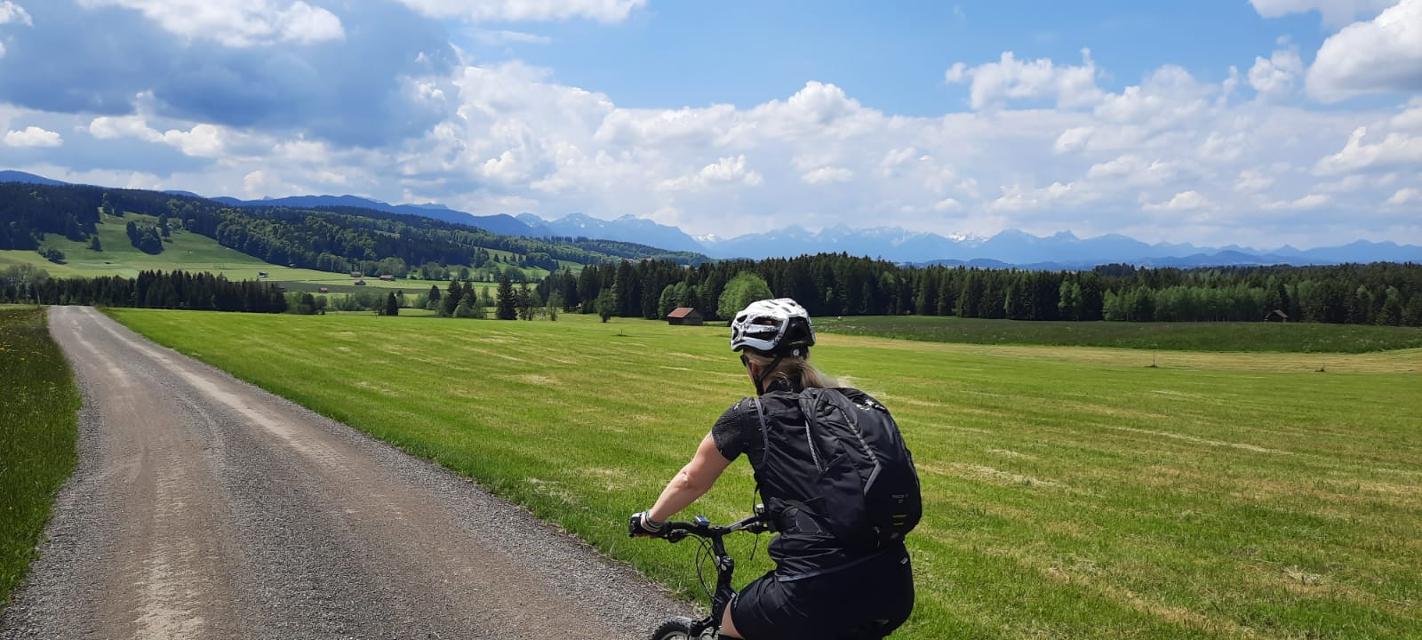
Radrundtour Steingaden-Rottenbuch-Wildsteig
Aussichtsreiche Rundtour von Steingaden über Rottenbuch nach Wildsteig und zurück.
2:55 h 441 hm 335 hm 36,5 km mittel
ca. 0,1 km entfernt
Osterbichl-Rundweg
Der Osterbichl-Rundweg führt uns durch das wunderschöne Voralpenland, wo Wanderer die sanfte Hügellandschaft östlich von Steingaden durchstreifen. Auf dieser Tour taucht man in den malerischen Brunnhäuslwald ein. Wann immer dieser verlassen wird, bieten sich wunderschöne Blicke auf die Alpen. Beschildert: Nr. 118, grün
1:15 h 118 hm 118 hm 4,6 km mittel
ca. 0,1 km entfernt
Lauterbach-Rundweg
In Steingaden beginnt der Rundweg nach Lauterbach. Vom Startpunkt führt der Weg über wenig befahrene Sträßchen und Forstwege nordöstlich von Steingaden. Ein Begleiter der Tour ist der grandiose Weitblick auf die Alpen und auf das Welfenmünster. Ausgeschildert ist der Weg mit der Nr. 119, blau.
2:15 h 142 hm 142 hm 7,3 km mittel
ca. 0,1 km entfernt
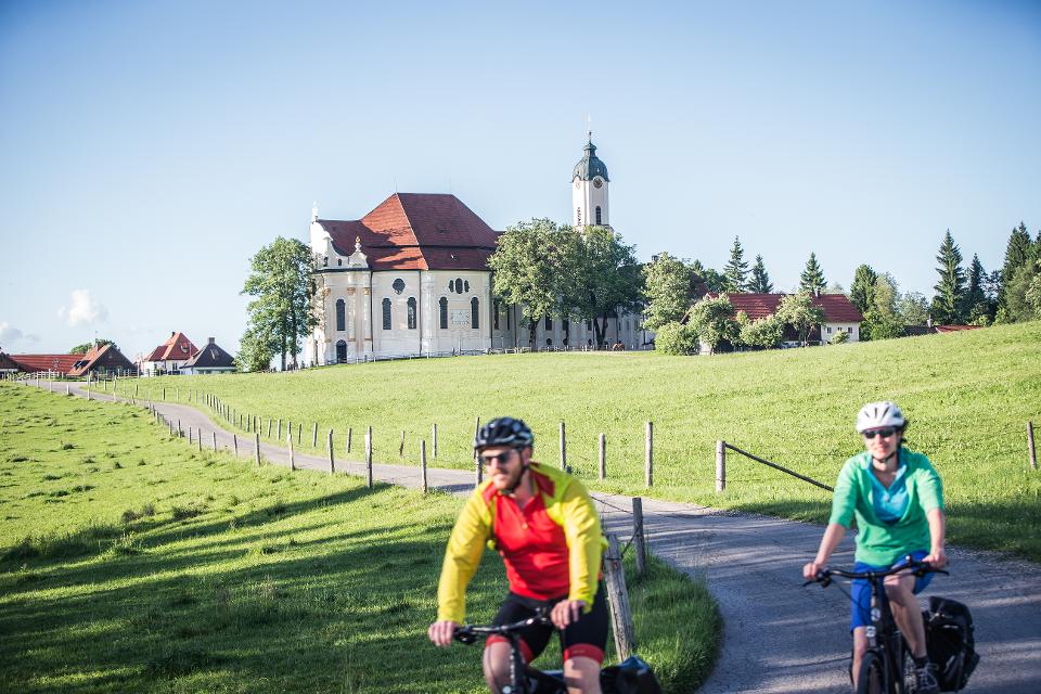
Wieskirchen-Runde
Erlebe die Wieskirche auf zwei Rädern! Ein einzigartiges Raderlebnis im Pfaffenwinkel für Kultur- und Naturliebhaber.
3:10 h 453 hm 453 hm 45,2 km mittel
ca. 0,1 km entfernt
Land der Moore: Radeln rund ums Wiesfilz
Die Schleife führt Radler durch die südwestlichste Ecke des Pfaffenwinkels.
2:15 h 211 hm 211 hm 30,2 km
ca. 0,1 km entfernt
Etappe 3, Westschleife, Heilige Landschaft Pfaffenwinkel - Von Steingaden zum Auerberg
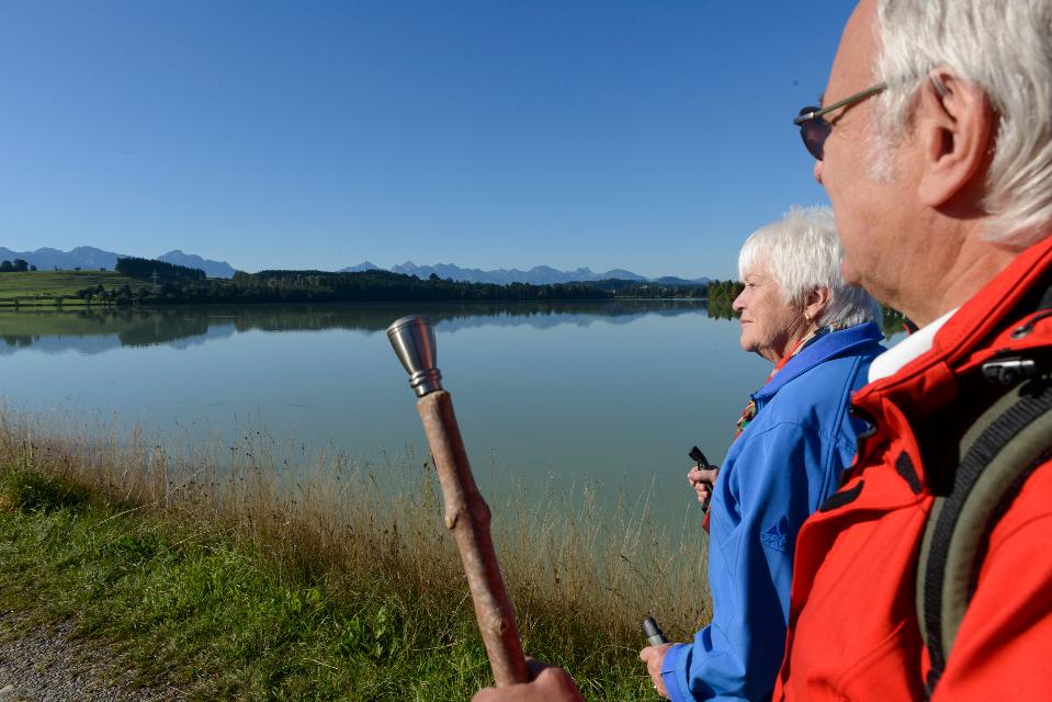
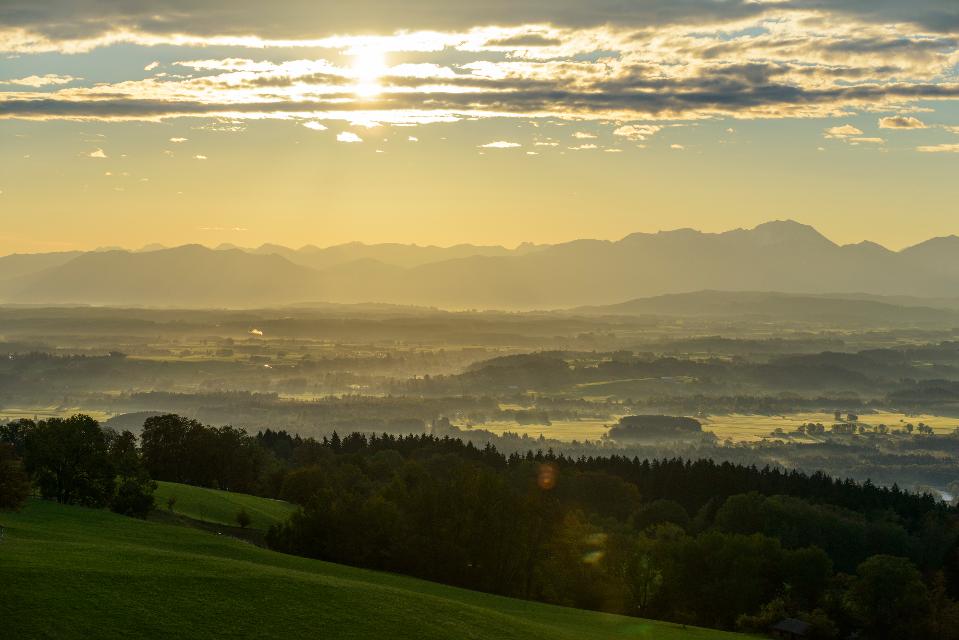
Ausgesprochen aussichtsreich führen uns die größtenteils gut ausgebauten Wege von Steingaden bis auf den Auerberg mit der weithin sichtbaren St. Georgs Kirche. Nachdem wir zunächst noch idyllisch entlang des Urspringer Lechstausees wandern, genießen wir auf dem Weg von Lechbruck in Richtung Auerberg fast durchgehend ein fantastisches Bergpanorama.
5:30 h 493 hm 212 hm 17,9 km sehr schwer
ca. 0,2 km entfernt
Wies-Runde
Schöne Rundtour mit tollem Bergblick zur berühmten Wieskirche.
0:55 h 117 hm 110 hm 11,3 km
ca. 0,2 km entfernt
Klostergarten "St. Johannes"
86989 Steingaen
Ehemaliger Klostergarten, der nach alten Vorbildern innerhalb eines Jahres in ehrenamtlicher Arbeit als Lehr- und Medidationsgarten neu gestaltet worden ist. „Heilung - Ernährung - Spiritualität – Muße“ Diese vier tragenden Säulen traditioneller, klösterlicher Gartenkultur werden in diesem Garten ganzheitlich erlebbar. Sehr gepflegte, botanische und artenreiche Pflanzenwelt Heilpflanzen, Bibelpflanzen, geschützte Pflanzen, Wildblumen, kultivierte Blumen des ländlichen Gartens, usw.
ca. 0,2 km entfernt
Panoramarunde Richtung Auerberg
Aussichtsreiche Rundtour Richtung Auerberg
2:45 h 371 hm 371 hm 37,2 km mittel
Das könnte Dir auch gefallen
"Das könnte Dir auch gefallen" überspringen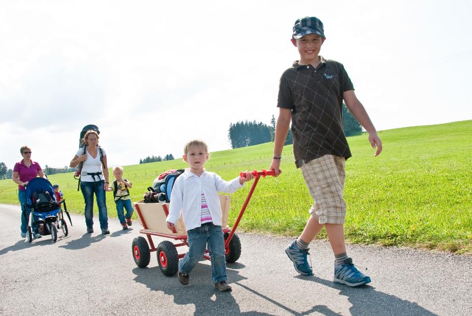
Pfaffenwinkler Milchweg
Auf dem Pfaffenwinkler Milchweg bei Schönegg können Wanderer alles rund um das Thema Milch Schritt für Schritt erleben. Auf dem Themenweg gibt es zehn Stationen, die Wissenswertes und Spannendes rund um das Thema Milch und Landwirtschaft kindgerecht präsentieren.
1:30 h 88 hm 89 hm 4,2 km sehr leicht
Schwarzlaichmoor
Bei einem gemütlichen Spaziergang wird das Naturschutzgebiet Schwarzlaichmoor östlich von Hetten einmal komplett umrundet. Vom Weg aus bieten sich immer wieder wunderschöne Ausblicke über die weitläufige Moorlandschaft hinweg zum Hohen Peißenberg mit der Wetterstation und der Wallfahrtskirche Mariä Himmelfahrt.
1:30 h 67 hm 67 hm 5,9 km sehr leicht
Enzianweg
Der landschaftlich reizvolle Rundweg hat allerlei Abwechslung zu bieten: weitläufige Wiesen, Felder und Moore, ein idyllisch gelegener See, ein erfrischender Badeweiher, zwei malerische Kapellen und nicht zuletzt ein fantastisches Bergpanorama. So geht es auf ruhigen, größtenteils asphaltierten Wegen genussvoll durch die wunderschöne Landschaft nordöstlich von Obersöchering. Beschildert: Nr. 11, blau
2:00 h 22 hm 22 hm 8,5 km sehr leicht
Lanzenbachweg
Idyllisch führt die Runde, die auf den Schildern mit der Nr. 8 auf blauem Grund zu finden ist, in stetem Auf und Ab durch die Wald- und Wiesenlandschaft östlich des Pollinger Weihers. Immer wieder genießen Spaziergänger traumhafte Ausblicke auf die Alpenkette. Im Reinthaler Bauernhofmuseum können allerlei alte landwirtschaftliche Geräte bestaunt werden. Direkt nebenan lohnt sich eine Einkehr im dazugehörigen Café. Beschildert: Nr. 8, blau
2:15 h 128 hm 128 hm 8,6 km mittel
Lauterbach-Rundweg
In Steingaden beginnt der Rundweg nach Lauterbach. Vom Startpunkt führt der Weg über wenig befahrene Sträßchen und Forstwege nordöstlich von Steingaden. Ein Begleiter der Tour ist der grandiose Weitblick auf die Alpen und auf das Welfenmünster. Ausgeschildert ist der Weg mit der Nr. 119, blau.
2:15 h 142 hm 142 hm 7,3 km mittel
Panoramaweg Schellenberg
Der Panoramaweg über den Schellenberg wird seinem Namen mehr als gerecht. Schon vom Weg aus, erst recht aber auf dem Schellenberg genießen Spaziergänger einen fantastischen Blick auf die Alpen und den Hohen Peißenberg. Beschildert: Nr. 17, grün
1:00 h 48 hm 48 hm 4,1 km sehr leicht
Storchenweg
Auf dem kurzen, flachen Rundweg genießen Spaziergänger über den freien Felder und Wiesen nordöstlich von Raisting ein traumhaftes Bergpanorama. Wer im Frühling oder Frühsommer unterwegs ist, kann mit etwas Glück häufig Störche beobachten, die während dieser Zeit in einem der zahlreichen Horste in und um den Ort nisten. Beschildert: Nr. 50, grün
1:00 h 22 hm 22 hm 4,1 km sehr leicht
Wald-Wanderweg
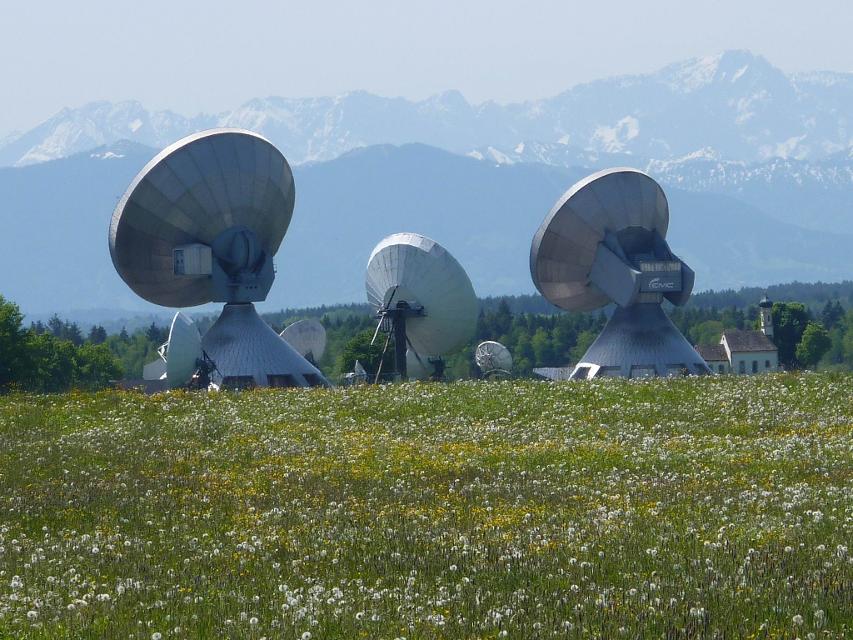
Der Wald-Wanderweg führt uns auf ruhigen Forstwegen durch idyllische Wälder. Die gemütliche Runde führt um die Ortschaft Raisting, die für ihre Erdfunkstelle große Bekanntheit genießt. Die weit sichtbaren Parabolantennen sind ein Wahrzeichen des Weilheimer Landes. Beschildert: Nr. 53, blau
1:30 h 64 hm 64 hm 6,8 km mittel
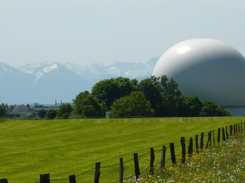
Erdfunkstellen-Wanderweg
Die eindrucksvolle, durchaus außergewöhnliche Spazierrunde führt einmal rund um die schon von Weitem sichtbare Erdfunkstelle südlich von Raisting. Mitten auf der grünen Wiese stehen hier riesige Antennen, welche bis heute für internationale Satellitenverbindungen und damit für weltweite Kommunikation genutzt werden. Beschildert: T51, grün
1:15 h 22 hm 22 hm 5,0 km sehr leicht
Alpenblick-Wanderung
Raisting liegt in Oberbayern in unmittelbarer Nähe zum Ammersee. Die Erdfunkstelle ist das Wahrzeichen der Gemeinde, die schon von weitem zu sehen ist. Die Alpenblick-Wanderung welche mit der Nr. 52 auf grünem Grund beschildert ist, belohnt die Spaziergänger nicht nur mit einem herrlichen Weitblick auf das Alpenmassiv, sondern auch mit einem Blick auf die Erdfunkstelle. Beschilderung: Nr. 52, grün
1:15 h 53 hm 53 hm 4,7 km sehr leicht
Winterwanderung - Pfaffenwinkler Milchweg
Auf dem Pfaffenwinkler Milchweg bei Schönegg können Wanderer alles rund um das Thema Milch Schritt für Schritt erleben. Auf dem Themenweg gibt es zehn Stationen, die Wissenswertes und Spannendes rund um das Thema Milch und Landwirtschaft kindgerecht präsentieren.
1:30 h 60 hm 61 hm 4,2 km sehr leicht
Hardtrunde (kurz)
Die kurze Version der Hardtrunde streift die typische Hardtlandschaft östlich von Weilheim nur am Rande. Im Zentrum steht vielmehr das sanfte Hügelland rund um den idyllischen Dietlhofer See, einem beliebten Badesee im Norden von Weilheim. Immer wieder genießen Spaziergänger wunderschöne Ausblicke auf den See und den Weiler Dietlhofen. Beschildert: Nr. 42, grün
1:00 h 47 hm 47 hm 3,9 km sehr leicht
Illach-Rundweg
Der flache Rundweg nahe der Illach führt Wanderer durch die weitläufige Landschaft des Pfaffenwinkels. Während Kulturinteressierte in Steingaden die Spuren der Welfendynastie erforschen können, ist für Naturliebhaber der türkisfarbene Lechstausee eine wunderbare Sehenswürdigkeit. Ausgeschildert mit der Nr. 120, rot.
2:30 h 154 hm 154 hm 9,4 km mittel
Schäfflerweg
Der Schäfflerweg ist eine wunderschöne Wanderrunde mit Start in Peißenberg, der Marktgemeinde des lebendig gebliebenen Bergbaus.
3:15 h 235 hm 235 hm 10,7 km mittel
Seewiesenweg
Die gemütliche Spazierrunde ist zwar kurz, aber dafür umso abwechslungsreicher. Begleitet von einem traumhaften Alpenpanorama führt der Weg nach Huglfing, bevor es durch die einzigartige Grasleitner Moorlandschaft zurück nach Oberhausen geht. Beschildert: Nr. 63, grün
1:00 h 47 hm 47 hm 4,0 km sehr leicht
Bergwetter-Weg
In exponierter Lage führt die Spazierrunde auf gut beschilderten Wegen zu den spannenden Sehenswürdigkeiten des Hohen Peißenbergs. Auf der Runde erwartet uns die älteste Bergwetterstation der Erde, eine Entdeckungsreise durch die Welt des Klimas und die Wallfahrtskirche Maria Himmelfahrt. Beschildert: Nr. 82, blau
1:30 h 196 hm 196 hm 4,8 km sehr leicht
Hardtrunde (lang)
Die ausgedehnte Runde führt über weite Strecken durch die einzigartige Hardtlandschaft mit Hoch- und Niedermooren, Magerrasen- und Streuwiesengebieten sowie weitläufigen Wäldern. Auf dem landschaftlich äußerst reizvollen Weg über kaum befahrene Sträßchen und ruhige Forstwege genießen Spaziergänger immer wieder traumhafte Ausblicke auf die Alpenkette. Beschildert: Nr. 44, rot
2:30 h 109 hm 109 hm 9,6 km mittel
Hardtrunde (mittel)
Die landschaftlich reizvolle Hardtrunde führt in ihrem östlichen Teil durch die wunderschöne, äußerst vielfältige Hardtlandschaft. Saftig grüne Wiesen wechseln sich immer wieder mit weitläufigen Wald- und Moorgebieten ab. Im Gegensatz dazu ist der westliche Teil der Runde geprägt durch die weiten, häufig landwirtschaftlich genutzten Felder und Wiesen rund um den Dietlhofer See, der sich im Sommer hervorragend zum Baden eignet. Beschildert: Nr. 43, blau
2:00 h 88 hm 88 hm 7,1 km sehr leicht
Kirchen-Rundweg Iffeldorf
Das Ziel des kurzen Rundwegs ist die Wallfahrtskirche St. Maria im Heuwinkl. Die als Heuwinklkapelle bekannte Kirche liegt wunderschön auf einer Anhöhe östlich von Iffeldorf. Sie gilt als eine der schönsten Kapellen im gesamten bayerischen Oberland. Durch ihre exponierte Lage und ihren originellen runden Bau mit der großen roten Kuppel ist sie schon von Weitem sichtbar. Beschildert: Nr. 24, grün
0:45 h 39 hm 39 hm 2,8 km sehr leicht
Peitnachrunde
Die Tour führt von Peiting zum Kalvarienberg und an der Peitnach entlang. Eine malerische Runde mit Alpenblick und Sicht auf den Hohen Peißenberg. Vor allem für Familien mit Kindern ist der Walderlebnispfad auf dem Kalvarienberg ein spannendes Erlebnis. Beschildert: Nr. 100, grün
2:00 h 147 hm 149 hm 6,4 km mittel
Rundweg um den Fohnsee
Inmitten des Naturschutzgebiets Osterseen bietet der Rundweg um den Fohnsee ein einzigartiges Naturerlebnis. Spaziergänger genießen immer wieder traumhafte Blicke über die weitläufige Seenlandschaft. Zahlreiche idyllische Plätze am Ufer des Fohnsees und des Großen Ostersees locken zum Verweilen. Beschildert: Nr. 23, grün
1:15 h 41 hm 41 hm 4,9 km sehr leicht
Stadt- und Lechgeschichten
Wissenswerte Geschichten ranken sich um die historische Altstadt Schongaus. Zuerst erleben wir jedoch romantische Wanderwege, ehe wir die Altstadt mit dem gotischen Ballenhaus, der barocken Stadtpfarrkirche Mariae Himmelfahrt und der begehbaren Stadtmauer entdecken.
3:45 h 276 hm 276 hm 13,9 km mittel
Stadt- und Waldrunde
Die ausgedehnte Stadt- und Waldrunde in und um Penzberg wartet mit abgelegenen Aussichtspunkten, traumhaften Gewässen und weitläufigen Filzgebieten in Stadtnähe auf. Im Erholungsgebiet Berghalde wandert man auf den Spuren des Bergbaus und erfährt Wissenswertes zur Geschichte der Stadt Penzberg. Für junge Wanderer ist das Freizeitgebiet Gut Hub eine spannende Abwechslung. Beschildert: Nr. 1, rot
4:45 h 225 hm 225 hm 18,2 km mittel
Stein-Erlebnisweg
Der Stein-Erlebnisweg steht ganz im Zeichen des Tuffstein- und Kiesabbaus rund um Huglfing. Vorbei an stillgelegten sowie noch heute genutzten Kiesgruben führt die ausgedehnte Runde durch die sanfte Hügellandschaft südlich und östlich der oberbayerischen Gemeinde. Beschildert: T62, rot
3:30 h 198 hm 198 hm 14,8 km mittel
Wald- und Weiherschleife
Die ausgedehnte Wald- und Weiherschleife, verläuft auf abwechslungsreichen Wegen mit vielen Sehenswürdigkeiten um Penzberg, die Stadt der 74 Nationen. Die Wanderung führt an landschaftlich reizvollen Plätzen vorbei, an romantischen Seen entlang und zu historischen Baudenkmälern. Auf dieser Runde präsentiert sich der Pfaffenwinkel von seiner schönsten Seite. Beschildert: Nr. 2, rot
4:30 h 242 hm 242 hm 16,4 km mittel

Wanderweg zum Hohen Peißenberg
Der Wanderweg zum Hohen Peißenberg ist eine anspruchsvolle Tour mit vielen Höhenmetern. Wenn der Berggipfel erreicht ist, wartet eine Vielzahl an Sehenswürdigkeiten und ein herrlicher Rundumblick auf erkundungsfreudige Wanderer. Die Wallfahrtskirche, das Observatorium und der Fernsehturm sind nur einige der Attraktionen. Für junge Wanderer ist der Wetterlehrpfad eine spannende Reise in die Welt des Klimas. Beschildert: Nr. 77, blau
3:15 h 381 hm 381 hm 10,7 km mittel